IMAGES TAKEN NEAR TO
Spurfield, WEST MOLESEY, KT8 1RS
Introduction
This page details the photographs taken nearby to Spurfield, KT8 1RS by members of the Geograph project.
The Geograph project started in 2005 with the aim of publishing, organising and preserving representative images for every square kilometre of Great Britain, Ireland and the Isle of Man.

There are currently over 7.5m images from over14,400 individuals and you can help contribute to the project by visiting https://www.geograph.org.uk
Image Map
Images are licensed for reuse under creativecommons.org/licenses/by-sa/2.0
Notes
- Clicking on the map will re-center to the selected point.
- The higher the marker number, the further away the image location is from the centre of the postcode.
Image Listing (30 Images Found)
Images are licensed for reuse under creativecommons.org/licenses/by-sa/2.0
Image
Details
Distance
2
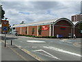
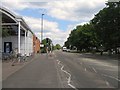
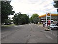
Mini-roundabout, Hurst Park
Tesco store and mini-roundabout at the junction of Hurst Road and Buckingham Avenue, East Molesey.
Image: © Malc McDonald
Taken: 20 Jun 2010
0.05 miles
6
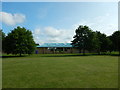
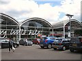
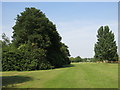
Molesey Hurst Recreation Ground
Molesey Hurst Recreation Ground entrance from The Fairway, East Molesey.
Image: © Malc McDonald
Taken: 20 Jun 2010
0.12 miles
7
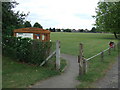
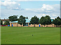
Play area, Molesey Hurst Recreation Ground
Image: © Robin Webster
Taken: 26 Aug 2012
0.17 miles
9
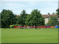
Hurst Pool, West Molesey
On the north side of Molesey Hurst Recreation Ground.
Image: © Robin Webster
Taken: 26 Aug 2012
0.20 miles