IMAGES TAKEN NEAR TO
Orchard Avenue, THAMES DITTON, KT7 0BB
Introduction
This page details the photographs taken nearby to Orchard Avenue, KT7 0BB by members of the Geograph project.
The Geograph project started in 2005 with the aim of publishing, organising and preserving representative images for every square kilometre of Great Britain, Ireland and the Isle of Man.

There are currently over 7.5m images from over14,400 individuals and you can help contribute to the project by visiting https://www.geograph.org.uk
Image Map
Images are licensed for reuse under creativecommons.org/licenses/by-sa/2.0
Notes
- Clicking on the map will re-center to the selected point.
- The higher the marker number, the further away the image location is from the centre of the postcode.
Image Listing (37 Images Found)
Images are licensed for reuse under creativecommons.org/licenses/by-sa/2.0
Image
Details
Distance
1
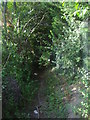
Ditch between Surbiton hockey club and Bankside Drive
This isn't a path, it's the space between the trees and the fence behind them.
Image: © David Howard
Taken: 19 Aug 2013
0.07 miles
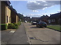
6
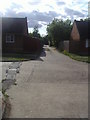
Alleyway on Bankside Drive, Long Ditton
Image: © David Howard
Taken: 19 Aug 2013
0.09 miles
8
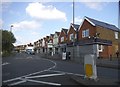
Angel Road, Thames Ditton, from the railway
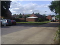
Image: © Christopher Hilton
Taken: 22 Mar 2016
0.10 miles
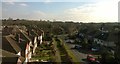
9
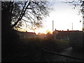
Sunset over Bankside Drive
At the exit to Stokes Field
Image: © David Howard
Taken: 24 Nov 2014
0.10 miles
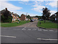
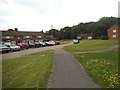
10
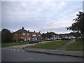
Bankside Drive at the junction of Sugden Lane
Image: © David Howard
Taken: 28 May 2017
0.11 miles