IMAGES TAKEN NEAR TO
South Lane, NEW MALDEN, KT3 5RS
Introduction
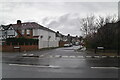
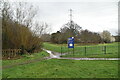
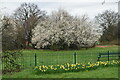
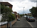
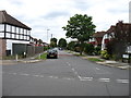
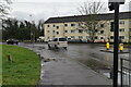
This page details the photographs taken nearby to South Lane, KT3 5RS by members of the Geograph project.
The Geograph project started in 2005 with the aim of publishing, organising and preserving representative images for every square kilometre of Great Britain, Ireland and the Isle of Man.

There are currently over 7.5m images from over14,400 individuals and you can help contribute to the project by visiting https://www.geograph.org.uk
Image Map
Images are licensed for reuse under creativecommons.org/licenses/by-sa/2.0
Notes
- Clicking on the map will re-center to the selected point.
- The higher the marker number, the further away the image location is from the centre of the postcode.
Image Listing (33 Images Found)
Images are licensed for reuse under creativecommons.org/licenses/by-sa/2.0
Image
Details
Distance
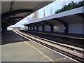
3
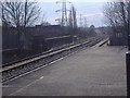
Railway lines from Malden Manor station
Image: © David Howard
Taken: 31 Mar 2008
0.17 miles
6
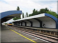
Malden Manor station
This station on the Chessington branch is named after the nearby Image The platforms are elevated above ground level and reached only by stairs. The architecture with the curved concrete platform canopies seems to be distinctive to this branch of the former Southern Railway. Compare Image at the next station down the line. For the exterior see Image
Image: © Stephen Craven
Taken: 22 May 2008
0.19 miles