IMAGES TAKEN NEAR TO
Millfield Lane, TADWORTH, KT20 6RP
Introduction
This page details the photographs taken nearby to Millfield Lane, KT20 6RP by members of the Geograph project.
The Geograph project started in 2005 with the aim of publishing, organising and preserving representative images for every square kilometre of Great Britain, Ireland and the Isle of Man.

There are currently over 7.5m images from over14,400 individuals and you can help contribute to the project by visiting https://www.geograph.org.uk
Image Map
Images are licensed for reuse under creativecommons.org/licenses/by-sa/2.0
Notes
- Clicking on the map will re-center to the selected point.
- The higher the marker number, the further away the image location is from the centre of the postcode.
Image Listing (15 Images Found)
Images are licensed for reuse under creativecommons.org/licenses/by-sa/2.0
Image
Details
Distance
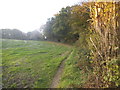
1
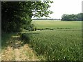
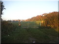
Fields of Barley
A gentle valley, flanked by fields of barley
Image: © Hywel Williams
Taken: 24 Jun 2005
0.17 miles
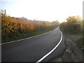
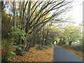
2
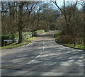
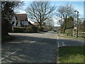
Millfield Lane, Lower Kingswood
Millfield Lane, Lower Kingswood at the junction with Chipstead Lane.
Image: © John Hilton
Taken: 11 Mar 2007
0.19 miles
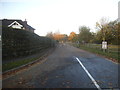
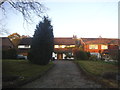
9
Green Lane, Lower Kingswood
Green Lane, Lower Kingswood at the junction of Smithy Lane (left) and the Fidelity Investments entrance (right).
Image: © John Hilton
Taken: 11 Mar 2007
0.23 miles