IMAGES TAKEN NEAR TO
Rowden Road, EPSOM, KT19 9PN
Introduction
This page details the photographs taken nearby to Rowden Road, KT19 9PN by members of the Geograph project.
The Geograph project started in 2005 with the aim of publishing, organising and preserving representative images for every square kilometre of Great Britain, Ireland and the Isle of Man.

There are currently over 7.5m images from over14,400 individuals and you can help contribute to the project by visiting https://www.geograph.org.uk
Image Map
Images are licensed for reuse under creativecommons.org/licenses/by-sa/2.0
Notes
- Clicking on the map will re-center to the selected point.
- The higher the marker number, the further away the image location is from the centre of the postcode.
Image Listing (20 Images Found)
Images are licensed for reuse under creativecommons.org/licenses/by-sa/2.0
Image
Details
Distance
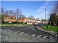
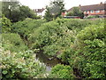
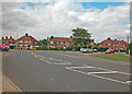
2
Rowden Road
Off Cox lane close to Hogsmill River.
Image: © Dennis Turner
Taken: 20 Aug 2005
0.08 miles
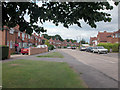
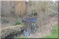
4
Tolworth Court Farm Fields
Local nature reserve on land marked on 1940s OS map as Sewage Works. Southern boundary of the reserve is the Hogsmill River.
Image: © Dennis Turner
Taken: 20 Aug 2005
0.20 miles
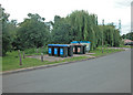
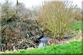
5
Ewell, Hogsmill River
Leafy stream flowing towards the Green Belt between Ewell and Kingston-upon-Thames.
Image: © Colin Smith
Taken: 3 Jul 2012
0.21 miles
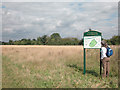
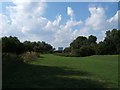
8
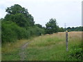
Footpath across Tolworth Court Farm Fields
Tolworth Court Farm Fields is a Local Nature Reserve and consists of a system of fields and hedgerows. At the time of the First Edition Ordnance Survey Map of 1865 this area was part of Tolworth Court Farm. At one stage up to the 1980s it was owned by the London Borough of Lambeth, who originally purchased it with the intention of laying out a cemetery. In the 1980s the Royal Borough of Kingston bought the form to formalise public access to the fields. Some of the hedges are at least 200 years old.
Each of the eight fields which make up Tolworth Court Farm Fields has a name - this footpath follows the edge of Great Meadow on its way to Kingston Road.
Image: © Marathon
Taken: 7 Aug 2013
0.22 miles
10
Hogsmill Open Space
The building straight ahead is Image on the A3.
Image: © Roger Miller
Taken: 2 Aug 2005
0.22 miles