IMAGES TAKEN NEAR TO
Iris Road, EPSOM, KT19 9NU
Introduction
This page details the photographs taken nearby to Iris Road, KT19 9NU by members of the Geograph project.
The Geograph project started in 2005 with the aim of publishing, organising and preserving representative images for every square kilometre of Great Britain, Ireland and the Isle of Man.

There are currently over 7.5m images from over14,400 individuals and you can help contribute to the project by visiting https://www.geograph.org.uk
Image Map
Images are licensed for reuse under creativecommons.org/licenses/by-sa/2.0
Notes
- Clicking on the map will re-center to the selected point.
- The higher the marker number, the further away the image location is from the centre of the postcode.
Image Listing (6 Images Found)
Images are licensed for reuse under creativecommons.org/licenses/by-sa/2.0
Image
Details
Distance
2
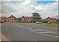
Rowden Road
Off Cox lane close to Hogsmill River.
Image: © Dennis Turner
Taken: 20 Aug 2005
0.08 miles
4
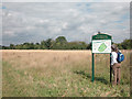
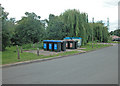
Tolworth Court Farm Fields
Local nature reserve on land marked on 1940s OS map as Sewage Works. Southern boundary of the reserve is the Hogsmill River.
Image: © Dennis Turner
Taken: 20 Aug 2005
0.21 miles
5
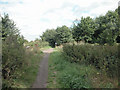
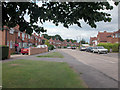
Nature reserve footpath
Footpath bordering Tolworth Court Farm nature reserve.
Image: © Dennis Turner
Taken: 20 Aug 2005
0.22 miles