IMAGES TAKEN NEAR TO
Hook Road, EPSOM, KT19 8QW
Introduction
This page details the photographs taken nearby to Hook Road, KT19 8QW by members of the Geograph project.
The Geograph project started in 2005 with the aim of publishing, organising and preserving representative images for every square kilometre of Great Britain, Ireland and the Isle of Man.

There are currently over 7.5m images from over14,400 individuals and you can help contribute to the project by visiting https://www.geograph.org.uk
Image Map
Images are licensed for reuse under creativecommons.org/licenses/by-sa/2.0
Notes
- Clicking on the map will re-center to the selected point.
- The higher the marker number, the further away the image location is from the centre of the postcode.
Image Listing (10 Images Found)
Images are licensed for reuse under creativecommons.org/licenses/by-sa/2.0
Image
Details
Distance
2
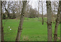
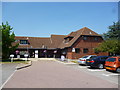
Horton Park golf club
From Horton Lane.
Image: © Hugh Venables
Taken: 30 Dec 2015
0.15 miles
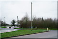
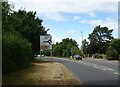
3
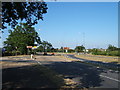
B284 near roundabout at junction with B2200, West Ewell
The roads in this vicinity have been improved recently to cope with traffic from the new housing developments on the former mental hospital sites to the west of Epsom.
Image: © Roger Miller
Taken: 16 Jul 2005
0.19 miles
4
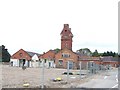
St. Ebba's Hospital redevelopment
Originally known as Ewell Epileptic Colony, St. Ebba's now cares for patients with mental illnesses. With changes to mental health services, most of the buildings are now considered surplus to requirements and are being demolished. The tower and one or two original buildings will be retained.
Image: © Dan Gregory
Taken: 7 Sep 2009
0.22 miles
5
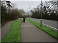
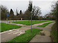
Foot and cycle paths by Horton Lane
Relatively obvious which is which...
Image: © Hugh Venables
Taken: 30 Dec 2015
0.23 miles
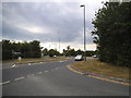
7
West Ewell
Roundabout at the junction of the B284 and B2200.
Image: © Peter Trimming
Taken: 4 Mar 2020
0.24 miles
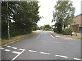
8
Chessington Road, West Ewell
The road was shifted for some reason, making a complicated junction and small dead end rather than a simple road with others off it. The road was almost identical before with a roundabout so can't imagine why they had to go to so much trouble changing it all.
Image: © David Howard
Taken: 23 Jun 2014
0.24 miles
9
Approaching roundabout on Chessington Road (B2200), Ewell
Image: © JThomas
Taken: 25 Jul 2022
0.24 miles
10
Chessington Road at the junction of Lansdowne Road
This used to be the main road but has now been bypassed.
Image: © David Howard
Taken: 23 Jun 2014
0.25 miles