IMAGES TAKEN NEAR TO
Fairway Close, EPSOM, KT19 0JZ
Introduction
This page details the photographs taken nearby to Fairway Close, KT19 0JZ by members of the Geograph project.
The Geograph project started in 2005 with the aim of publishing, organising and preserving representative images for every square kilometre of Great Britain, Ireland and the Isle of Man.

There are currently over 7.5m images from over14,400 individuals and you can help contribute to the project by visiting https://www.geograph.org.uk
Image Map
Images are licensed for reuse under creativecommons.org/licenses/by-sa/2.0
Notes
- Clicking on the map will re-center to the selected point.
- The higher the marker number, the further away the image location is from the centre of the postcode.
Image Listing (66 Images Found)
Images are licensed for reuse under creativecommons.org/licenses/by-sa/2.0
Image
Details
Distance
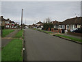
1
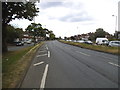
Kingston Road, Ewell
Epsom and Ewell stretch for some miles from the Hogsmill River just behind here and the end of Epsom at the other end of the road.
Image: © David Howard
Taken: 23 Jun 2014
0.04 miles
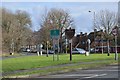
2
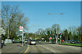
A240 Kingston Road - Worcester Park Road bus stop
For buses 406 and 418 towards Surbiton.
Image: © Robin Webster
Taken: 1 Apr 2012
0.06 miles
3
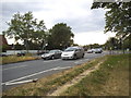
Kingston Road, Ewell
London and Tolworth end just over the road where it crosses the Hogsmill River
Image: © David Howard
Taken: 23 Jun 2014
0.07 miles
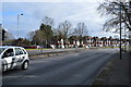
5
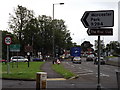
Entering Epsom & Ewell
Kingston Road, Ewell and a number of road signs announcing the County of Surrey, the Borough of Epsom & Ewell, 30 mph speed limit, the way to Worcester Park and to the River Club.
Image: © Colin Smith
Taken: 3 Jul 2012
0.08 miles
9

Path to Chessington Road, Ewell
Running alongside the Hogsmill River, this also skirts the boundary of Surrey and London on the right of the river.
Image: © David Howard
Taken: 23 Jun 2014
0.10 miles
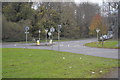
10
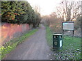
London LOOP near Tolworth
A view along a path which forms part of the route of the London LOOP, near Tolworth on the fringe of south west London.
Image: © Malc McDonald
Taken: 25 Feb 2023
0.11 miles