IMAGES TAKEN NEAR TO
Courtlands Drive, EPSOM, KT19 0AN
Introduction
This page details the photographs taken nearby to Courtlands Drive, KT19 0AN by members of the Geograph project.
The Geograph project started in 2005 with the aim of publishing, organising and preserving representative images for every square kilometre of Great Britain, Ireland and the Isle of Man.

There are currently over 7.5m images from over14,400 individuals and you can help contribute to the project by visiting https://www.geograph.org.uk
Image Map
Images are licensed for reuse under creativecommons.org/licenses/by-sa/2.0
Notes
- Clicking on the map will re-center to the selected point.
- The higher the marker number, the further away the image location is from the centre of the postcode.
Image Listing (39 Images Found)
Images are licensed for reuse under creativecommons.org/licenses/by-sa/2.0
Image
Details
Distance
2
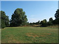
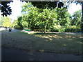
Part of the Hogsmill Open Space near Ewell
The Hogsmill Open Space borders the Hogsmill River from the Lower Mill in Ewell to the borough boundary with the Royal Borough of Kingston in Worcester Park. This photo was taken at approximately TQ 213 634 looking south.
Image: © Roger Miller
Taken: 16 Jul 2005
0.09 miles
3
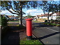
Pillar box on Meadow Walk
The bright red of a pillar box always brightens up a photo, even on a sunny day.
Image: © Marathon
Taken: 23 Oct 2013
0.11 miles
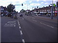
4
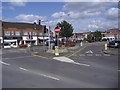
Bradford Drive junction with Kingston Road, Stoneleigh
Image: © David Howard
Taken: 22 Jun 2008
0.15 miles
5
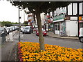
Kingston Road, Stoneleigh
Shopping parades line both sides of the busy and dualled Kingston Road at Stoneleigh. The flower beds add a welcome splash of colour to the suburban scene.
Image: © Colin Smith
Taken: 17 Jul 2012
0.16 miles
6
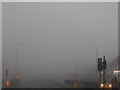
A polar bear in the snow
Kingston Road, Stoneleigh. I was very lucky the fog stopped in Burgh Heath going south where I wanted to take photos, otherwise they'd all have looked like this as it was solid as far as Richmond and beyond.
Image: © David Howard
Taken: 1 Nov 2015
0.17 miles
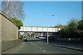
7
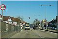
A240 - traffic lights
To the left is the only way in or out by road for a residential area of several hundred houses.
Image: © Robin Webster
Taken: 1 Apr 2012
0.17 miles
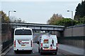
10
Railway bridge over Ewell Bypass
A welded plate girder bridge on the Raynes Park to Epsom line.
Image: © Robin Webster
Taken: 1 Apr 2012
0.17 miles