1
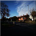
44-46 and 48-52 Castle Road
A pair of houses on Castle Road. Nos 48-52, further from the camera, are late Victorian.
Image: © Ian Capper
Taken: 27 Oct 2017
0.04 miles
2
Castle House
Originally a single farmhouse dating back to the 18th Century. The two end sections were added in the early 19th Century, including the turreted tower on the left, at which point it became known as Castle House, with the lane on which it stood being named Castle Road. The enlarged house is believed to have been subdivided into the current five properties in 1883.
The building is grade II listed in three parts: www.historicengland.org.uk/listing/the-list/list-entry/1212235 for the turreted end (no 62), www.historicengland.org.uk/listing/the-list/list-entry/1028613 for the central section (no 56-60) and www.historicengland.org.uk/listing/the-list/list-entry/1028612 for the right hand section (no 54).
A full article on the house can be read at http://www.epsomandewellhistoryexplorer.org.uk/CastleRoad56.html.
Image: © Ian Capper
Taken: 27 Oct 2017
0.06 miles
3
Ebbisham Road
1930s housing. The name commemorates the original name of Epsom, Ebba's Ham, later Evesham or Ebbisham. Confusingly, the name Ebbisham Road applies to both a hexagon shaped circuit of houses (a section of which is seen here) together with two spurs off it, one to the south and one to the west.
Image: © Ian Capper
Taken: 27 Oct 2017
0.07 miles
4
Ebbisham Road
1930s housing. The name commemorates the original name of Epsom, Ebba's Ham, later Evesham or Ebbisham. Confusingly, the name Ebbisham Road applies to both a hexagon shaped circuit of houses (a section of which is seen here) together with two spurs off it, one to the south and one to the west.
Image: © Ian Capper
Taken: 27 Oct 2017
0.08 miles
5
Ebbisham Road
1930s housing. The name commemorates the original name of Epsom, Ebba's Ham, later Evesham or Ebbisham. Confusingly, the name Ebbisham Road applies to both a hexagon shaped circuit of houses together with two spurs off it, one to the south (see here) and one to the west.
Image: © Ian Capper
Taken: 27 Oct 2017
0.09 miles
6
Ebbisham Road
1930s housing. The name commemorates the original name of Epsom, Ebba's Ham, later Evesham or Ebbisham. Confusingly, the name Ebbisham Road applies to both a hexagon shaped circuit of houses (a section of which is seen here) together with two spurs off it, one to the south and one to the west.
Image: © Ian Capper
Taken: 27 Oct 2017
0.09 miles
7
Dorking Road
Houses on the A24 close to the end of the urban sprawl.
Image: © James Emmans
Taken: 14 Nov 2019
0.10 miles
8
Ebbisham Road
1930s housing. The name commemorates the original name of Epsom, Ebba's Ham, later Evesham or Ebbisham. Confusingly, the name Ebbisham Road applies to both a hexagon shaped circuit of houses together with two spurs off it, one to the south (seen here) and one to the west.
Image: © Ian Capper
Taken: 27 Oct 2017
0.10 miles
9
Epsom Common footpath passing the Railway Bridge
Image: © James Emmans
Taken: 14 Nov 2019
0.11 miles
10
Bucknills Close
1930s housing off Ebbisham Road.
Image: © Ian Capper
Taken: 27 Oct 2017
0.13 miles


