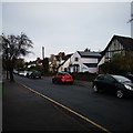
IMAGES TAKEN NEAR TO
Dorking Road, EPSOM, KT18 7NN

Introduction

This page details the photographs taken nearby to Dorking Road, KT18 7NN by members of the Geograph project.

The Geograph project started in 2005 with the aim of publishing, organising and preserving representative images for every square kilometre of Great Britain, Ireland and the Isle of Man.

There are currently over 7.5m images from over14,400 individuals and you can help contribute to the project by visiting https://www.geograph.org.uk

Image Map


Images are licensed for reuse under creativecommons.org/licenses/by-sa/2.0
Notes
  • Clicking on the map will re-center to the selected point.
  • The higher the marker number, the further away the image location is from the centre of the postcode.

Image Listing (23 Images Found)

Images are licensed for reuse under creativecommons.org/licenses/by-sa/2.0
  • ...
Image
Details
Distance
1
Grace Baptist Chapel and Cornerways
Baptist chapel in Dorking Road built in 1951, with the congregation of the Bugby Chapel in Prospect Place transferring here in that year. Next to it is Cornerways, a 1950s semi-detached house.
Image: © Ian Capper Taken: 27 Oct 2017
0.02 miles
2
Orchard Gardens
1930s cul-de-sac built in the walled kitchen garden of The Elms, a large house slightly further to the east, now called Hardy House. Part of the original garden wall can be seen on the left; dating from the 18th Century, it is grade II listed - see www.historicengland.org.uk/listing/the-list/list-entry/1213469.
Image: © Ian Capper Taken: 27 Oct 2017
0.04 miles
3
Dorking Road Epsom
The A24
Image: © David Howard Taken: 9 Aug 2009
0.05 miles
4
Whitmores Close
1950s cul-de-sac off Dorking Road.
Image: © Ian Capper Taken: 27 Oct 2017
0.05 miles
5
Whitmores Close
1950s cul-de-sac off Dorking Road.
Image: © Ian Capper Taken: 27 Oct 2017
0.05 miles
6
Ebbisham Road
1930s housing. The name commemorates the original name of Epsom, Ebba's Ham, later Evesham or Ebbisham. Confusingly, the name Ebbisham Road applies to both a hexagon shaped circuit of houses together with two spurs off it, one to the south (seen here) and one to the west.
Image: © Ian Capper Taken: 27 Oct 2017
0.06 miles
7
Ebbisham Road
1930s housing. The name commemorates the original name of Epsom, Ebba's Ham, later Evesham or Ebbisham. Confusingly, the name Ebbisham Road applies to both a hexagon shaped circuit of houses together with two spurs off it, one to the south (see here) and one to the west.
Image: © Ian Capper Taken: 27 Oct 2017
0.07 miles
8
Dorking Road, Epsom
Image: © Stacey Harris Taken: 12 Dec 2010
0.10 miles
9
White Horse Drive
Detached houses on a Cul-de-Sac road.
Image: © James Emmans Taken: 14 Nov 2019
0.10 miles
10
Bucknills Close
1930s housing off Ebbisham Road.
Image: © Ian Capper Taken: 27 Oct 2017
0.10 miles
  • ...