IMAGES TAKEN NEAR TO
Hurst Road, EPSOM, KT18 6DP
Introduction
This page details the photographs taken nearby to Hurst Road, KT18 6DP by members of the Geograph project.
The Geograph project started in 2005 with the aim of publishing, organising and preserving representative images for every square kilometre of Great Britain, Ireland and the Isle of Man.

There are currently over 7.5m images from over14,400 individuals and you can help contribute to the project by visiting https://www.geograph.org.uk
Image Map
Images are licensed for reuse under creativecommons.org/licenses/by-sa/2.0
Notes
- Clicking on the map will re-center to the selected point.
- The higher the marker number, the further away the image location is from the centre of the postcode.
Image Listing (13 Images Found)
Images are licensed for reuse under creativecommons.org/licenses/by-sa/2.0
Image
Details
Distance
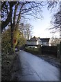
1
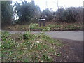
Hurst Road at the junction of Hurst Lane
Image: © David Howard
Taken: 20 Feb 2012
0.07 miles
2
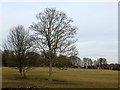
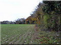
Field with trees at Hurst Farm
A view from Hurst Lane.
Image: © Stephen Craven
Taken: 31 Jan 2010
0.07 miles
3
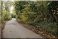
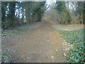
Hurst Lane
Close to the M25, north of Headley. The hazel bushes are marked for coppicing, which happens every few years.
Image: © Peter Trimming
Taken: 9 Dec 2014
0.12 miles
4
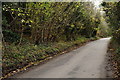
Hurst Lane
Close to the M25, north of Headley. The hazel bushes are marked for coppicing, which happens every few years.
Image: © Peter Trimming
Taken: 9 Dec 2014
0.15 miles
5
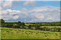
Field edge off Hurst Road
The M25 is well hidden by Hurst Wood at the end of the field.
Image: © Robin Webster
Taken: 23 Nov 2010
0.15 miles
6
Northeast from Hurst Lane
Looking northeast from Hurst Lane with houses on Epsom Lane North in the distance.
Image: © Ian Capper
Taken: 12 May 2017
0.17 miles
7
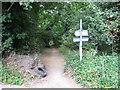
Entrance to Sheep Walk
The path is also used as a cycle route.
Image: © don cload
Taken: 12 Sep 2012
0.18 miles
9
North Lodge
There are very few habitations in this grid-square - and this contribution seems to be the first to show one.
The name suggests that this was once an entrance lodge to a big estate. Perhaps that was Headley Park, now on the far side of the M25.
Just across the road from the house is the entrance to a bridleway known as the Sheep Walk - which also gives access to the Woodland Trust's Langley Vale Wood.
Image: © Stefan Czapski
Taken: 25 Jan 2018
0.18 miles
10
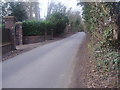
Walton Road near Ashtead
By the entrance to North Lodge
Image: © David Howard
Taken: 20 Feb 2012
0.19 miles