IMAGES TAKEN NEAR TO
Langley Vale Road, EPSOM, KT18 6BB
Introduction
This page details the photographs taken nearby to Langley Vale Road, KT18 6BB by members of the Geograph project.
The Geograph project started in 2005 with the aim of publishing, organising and preserving representative images for every square kilometre of Great Britain, Ireland and the Isle of Man.

There are currently over 7.5m images from over14,400 individuals and you can help contribute to the project by visiting https://www.geograph.org.uk
Image Map
Images are licensed for reuse under creativecommons.org/licenses/by-sa/2.0
Notes
- Clicking on the map will re-center to the selected point.
- The higher the marker number, the further away the image location is from the centre of the postcode.
Image Listing (23 Images Found)
Images are licensed for reuse under creativecommons.org/licenses/by-sa/2.0
Image
Details
Distance
1
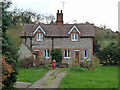
Nohome Farm
Apparently a pair of cottages in a common garden. I had to advance a few paces through the open gate for this shot, but nobody seemed at home!
Image: © Robin Webster
Taken: 22 Nov 2010
0.00 miles
2
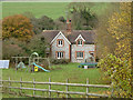
Nohome Farm
Apparently a pair of cottages in a common garden.
Image: © Robin Webster
Taken: 22 Nov 2010
0.00 miles
4
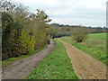
Bridleway towards Walton Downs
From Walton-on-the-Hill.
Image: © Robin Webster
Taken: 22 Nov 2010
0.01 miles
5
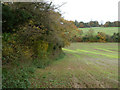
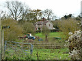
Field east of Nohome Farm
Looking towards Walton Downs.
Image: © Robin Webster
Taken: 22 Nov 2010
0.03 miles
6
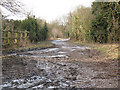
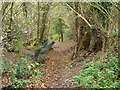
Frozen track at Nohome Farm
This is the 'dead end' of the track as far as vehicles are concerned, looking back towards the road.
Image: © Stephen Craven
Taken: 31 Jan 2010
0.04 miles
7
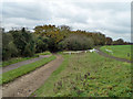
Parallel horse ways
There were signs pointing out that the route on the right was for racehorses only. The public bridleway is on the left for humbler beasts, but the middle sand track is available to all after noon each day.
Image: © Robin Webster
Taken: 22 Nov 2010
0.07 miles
8
Parallel horse ways
There were signs pointing out that the route on the far right (surface out of sight) was for racehorses only. The public bridleway is on the left for humbler beasts, but the middle sand track is available to all after noon each day.
Image: © Robin Webster
Taken: 22 Nov 2010
0.09 miles
9
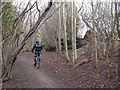
Mountain biker in Downs View Wood
The track through the woods is a bridleway. Despite this being a very "horsey" area there was no evidence (in terms of droppings or horseshoe marks) of it being used by horse riders, perhaps because the track is very narrow further up the hill towards Walton, but there were several mountain bikers out on this Sunday morning.
Image: © Stephen Craven
Taken: 31 Jan 2010
0.13 miles
10
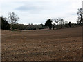
Dry valley, Walton Downs
There is no evidence of a surface stream at the bottom of this shallow valley, but that is not unusual in chalk downland.
Image: © Stephen Craven
Taken: 31 Jan 2010
0.15 miles