IMAGES TAKEN NEAR TO
Dell Lane, EPSOM, KT17 2NE
Introduction
This page details the photographs taken nearby to Dell Lane, KT17 2NE by members of the Geograph project.
The Geograph project started in 2005 with the aim of publishing, organising and preserving representative images for every square kilometre of Great Britain, Ireland and the Isle of Man.

There are currently over 7.5m images from over14,400 individuals and you can help contribute to the project by visiting https://www.geograph.org.uk
Image Map
Images are licensed for reuse under creativecommons.org/licenses/by-sa/2.0
Notes
- Clicking on the map will re-center to the selected point.
- The higher the marker number, the further away the image location is from the centre of the postcode.
Image Listing (38 Images Found)
Images are licensed for reuse under creativecommons.org/licenses/by-sa/2.0
Image
Details
Distance
6
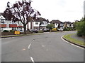
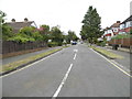
Briarwood Road becoming Kenilworth Road
The corner provides a change of name
Image: © David Howard
Taken: 15 Jun 2014
0.08 miles
7
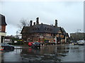
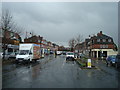
The Stoneleigh public house, Stoneleigh
Image: © Stacey Harris
Taken: 29 Nov 2009
0.09 miles