IMAGES TAKEN NEAR TO
The Glade, EPSOM, KT17 2HW
Introduction
This page details the photographs taken nearby to The Glade, KT17 2HW by members of the Geograph project.
The Geograph project started in 2005 with the aim of publishing, organising and preserving representative images for every square kilometre of Great Britain, Ireland and the Isle of Man.

There are currently over 7.5m images from over14,400 individuals and you can help contribute to the project by visiting https://www.geograph.org.uk
Image Map
Images are licensed for reuse under creativecommons.org/licenses/by-sa/2.0
Notes
- Clicking on the map will re-center to the selected point.
- The higher the marker number, the further away the image location is from the centre of the postcode.
Image Listing (35 Images Found)
Images are licensed for reuse under creativecommons.org/licenses/by-sa/2.0
Image
Details
Distance
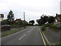
1
Junctions on Briarwood Road, Stoneleigh
Image: © David Howard
Taken: 15 Jun 2014
0.09 miles
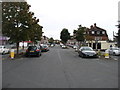
3
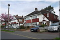
Woodstone Avenue
These 1930's semi detached houses have been considerably extended to result in large houses. As 3 bedroom houses they can sell for up to £500,000 but as five bedroom extended properties they are currently selling for about £600,000 (April 2015)
Image: © Nigel Mykura
Taken: 17 Apr 2015
0.10 miles
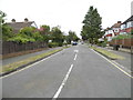
4
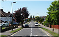
Briarwood Road, Stoneleigh
Recognisably typical 1930s suburbia.
Image: © Stephen Richards
Taken: Unknown
0.12 miles