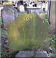
1
Vicarage Lane, Ewell
Formerly the main route north out of Ewell (before the road was diverted to accommodate the establishment of Nonsuch Palace), now a public footpath to the Ewell bypass. Behind are the buildings of Ewell Castle School.
Image: © Hugh Craddock
Taken: 22 Feb 2009
0.02 miles
2
Ewell Castle School, Church Street
Image: © Hugh Craddock
Taken: 22 Feb 2009
0.02 miles
3
Ewell Castle School
Grade II listed. https://www.britishlistedbuildings.co.uk/101214625-ewell-castle-epsom-and-ewell
Image: © N Chadwick
Taken: 4 Feb 2018
0.03 miles
4
Ewell Castle School
Grade II listed. https://www.britishlistedbuildings.co.uk/101214625-ewell-castle-epsom-and-ewell
Image: © N Chadwick
Taken: 4 Feb 2018
0.03 miles
5
Tombstone detail (1774), Ewell churchyard
The winged skull is a fairly common motif on 18th-century tombstones. The stone commemorates Sarah Burges, who died at the age of 21. I find it hard to believe that her husband John (also named on the stone) was in any way comforted by the image.
The date given - if I've read it correctly - is 'Mar. ye 20th, 1774'.
Image: © Stefan Czapski
Taken: 10 Jan 2018
0.04 miles
6
Tombstone in Ewell churchyard: Sarah Burges, 1774
The 'old' part of the churchyard is at the eastern end, around the tower of the ruined church - where there are dozens of 18th-century stones.
This one marks the grave of:
SARAH Wife of JOH. BURGES
Who died Mar. ye 20th 1774 Aged 21
Years
Image: © Stefan Czapski
Taken: 10 Jan 2018
0.04 miles
7
London Loop, Ewell
Image: © N Chadwick
Taken: 4 Feb 2018
0.04 miles
8
Churchyard wall, St Mary's
Image: © N Chadwick
Taken: 4 Feb 2018
0.04 miles
9
Ewell: the tower of the ruined church
Apart from this tower, little is left of Ewell's medieval parish church. The tower is somewhat hemmed in by tall conifers, so that even in mid-December I was unable to get an open view from a distance. In the area around the tower (at the southern end of the churchyard) there are dozens (possibly hundreds) of Georgian tombstones - so perhaps the old church was not abandoned until its replacement was built.
The current church dates from 1848, and stands a few hundred yards further north, at the far end of the extensive churchyard.
Image: © Stefan Czapski
Taken: 18 Dec 2017
0.04 miles
10
Ewell : Ewell Castle
Built in Church Street, Ewell in 1814 for Thomas Calverley from a design by architect Henry Kitchen.
Image: © Jim Osley
Taken: 15 Aug 2018
0.05 miles


