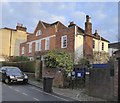
IMAGES TAKEN NEAR TO
Church Street, EPSOM, KT17 2AU

Introduction

This page details the photographs taken nearby to Church Street, KT17 2AU by members of the Geograph project.

The Geograph project started in 2005 with the aim of publishing, organising and preserving representative images for every square kilometre of Great Britain, Ireland and the Isle of Man.

There are currently over 7.5m images from over14,400 individuals and you can help contribute to the project by visiting https://www.geograph.org.uk

Image Map


Images are licensed for reuse under creativecommons.org/licenses/by-sa/2.0
Notes
  • Clicking on the map will re-center to the selected point.
  • The higher the marker number, the further away the image location is from the centre of the postcode.

Image Listing (170 Images Found)

Images are licensed for reuse under creativecommons.org/licenses/by-sa/2.0
  • ...
Image
Details
Distance
1
Church St, Ewell
Image: © N Chadwick Taken: 4 Feb 2018
0.00 miles
2
Church Street
Historic street in the centre of Ewell containing some fine old Georgian houses. http://www.epsomandewellhistoryexplorer.org.uk/
Image: © Colin Smith Taken: 17 Jul 2012
0.01 miles
3
Ewell: Church Street - Malt End Cottage and Tabards
According to the Listing text, the 18th century façade conceals an older building - and the photo shows this to be a somewhat rambling structure, reaching well back from the road. The façade is said to be of 'mathematical' tiles (see my comments on 'Roslyn' nearby: https://www.geograph.org.uk/photo/5649781 ). The names Malt End Cottage and Tabards indicate that the somewhat rambling building has been divided. The window layout shows that some rooms are centrally placed under the gable - so (whatever the arrangement) the units cannot be symmetrical 'semis'. Listing text: https://www.britishlistedbuildings.co.uk/101214623-malt-end-cottagetabards-epsom-and-ewell#.WlibKSiGno5
Image: © Stefan Czapski Taken: 10 Jan 2018
0.01 miles
4
Church Street, Ewell
On the London Loop leading from Ewell town centre towards Nonsuch Park.
Image: © Des Blenkinsopp Taken: 26 Mar 2012
0.02 miles
5
Church St, Ewell
Image: © N Chadwick Taken: 4 Feb 2018
0.02 miles
6
Ewell: Church Street
Looking south-east from a point close to the southern end of the extensive churchyard. An afternoon photograph, taken a week before Christmas.
Image: © Stefan Czapski Taken: 18 Dec 2017
0.02 miles
7
High Street, Ewell - junction with Cheam Road
Looking in the direction of the Kingston Road.
Image: © Roger Miller Taken: 9 Jul 2005
0.02 miles
8
St Michael's Church, Ewell
A small non-denominational church.
Image: © Bill Boaden Taken: 1 Aug 2011
0.02 miles
9
King William IV, Ewell
Commemorative plaque from Epsom & Ewell's Rotary Club on the wall of the old King William IV public house on Ewell's High Street at its corner with Church Street. http://www.epsomandewellhistoryexplorer.org.uk/
Image: © Colin Smith Taken: 17 Jul 2012
0.03 miles
10
Watch House, Ewell
Historic lock-up and fire engine shelter (ca. 1780) on Church Street in the centre of Ewell. http://www.epsomandewellhistoryexplorer.org.uk/
Image: © Colin Smith Taken: 17 Jul 2012
0.03 miles
  • ...