IMAGES TAKEN NEAR TO
Vickers Close, CHERTSEY, KT16 0BZ

Introduction

This page details the photographs taken nearby to Vickers Close, KT16 0BZ by members of the Geograph project.

The Geograph project started in 2005 with the aim of publishing, organising and preserving representative images for every square kilometre of Great Britain, Ireland and the Isle of Man.

There are currently over 7.5m images from over14,400 individuals and you can help contribute to the project by visiting https://www.geograph.org.uk

Image Map


Images are licensed for reuse under creativecommons.org/licenses/by-sa/2.0
Notes
  • Clicking on the map will re-center to the selected point.
  • The higher the marker number, the further away the image location is from the centre of the postcode.

Image Listing (10 Images Found)

Images are licensed for reuse under creativecommons.org/licenses/by-sa/2.0
Image
Details
Distance
1
Golf Course
Image: © N Chadwick Taken: 13 Feb 2016
0.09 miles
2
Footpath East of Longcross Station
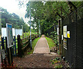
Between the railway and Qinetiq (MOD / DERA site as was) is a permissive footpath. Signs here say "This is not a public right of way. This footpath is closed each Christmas Day".
Image: © Martyn Davies Taken: 22 Mar 2006
0.09 miles
3
Borough of Runnymede : M3 Motorway
The M3 Motorway between Junction 2 (Thorpe Interchange) and Junction 3 (Bagshot Interchange).
Image: © Lewis Clarke Taken: 25 Mar 2018
0.10 miles
4
Bat Box in the Woods
I'm guessing that's what this is. The only entrance is via some thin slats in the base, so it's not going to be for owls.
Image: © Des Blenkinsopp Taken: 7 Nov 2016
0.10 miles
5
Improved Path to Longcross Station
The very isolated station at Longcross which at one time had a service of only two trains a day is seeing increased use with new housing being built nearby. Former military land is now becoming a fair sized community and this new pathway with lighting has been made along the little used track which looked like this Image when I was last here. There is still no vehicle access to the station at present.
Image: © Des Blenkinsopp Taken: 6 Jun 2018
0.12 miles
6
Building Site at Longcross
Brownfield land at a former MOD site is being redeveloped. This could mean yet more passengers for the isolated Longcross Station nearby, which has been seeing a steady increase in footfall since the MOD moved out.
Image: © Des Blenkinsopp Taken: 7 Nov 2016
0.16 miles
7
Chobham Lane
Here running beside the M3, just through the hedge on the right.
Image: © Robin Webster Taken: 13 Sep 2014
0.17 miles
8
Path by the Perimeter
This path is on a narrow strip between the railway and the fence around a former MOD site. It is the less easy of the two footpaths which provide the only access to the very isolated Longcross Station. It's not a right of way. It is supposedly closed on Christmas Day as an overgrown notice at the eastern end points out. Somehow I doubt they do.
Image: © Des Blenkinsopp Taken: 7 Nov 2016
0.20 miles
9
Footpath leading east from Longcross station
There is no road access to this station. This made-up footpath leads to the Crest Nicholson housing development at Upper Longcross.
Image: © David Kemp Taken: 1 Jul 2023
0.25 miles
10
M3 passing MOD Chertsey
Image: © Fernweh Taken: 11 Feb 2012
0.25 miles