IMAGES TAKEN NEAR TO
Almners Road, CHERTSEY, KT16 0BH
Introduction
This page details the photographs taken nearby to Almners Road, KT16 0BH by members of the Geograph project.
The Geograph project started in 2005 with the aim of publishing, organising and preserving representative images for every square kilometre of Great Britain, Ireland and the Isle of Man.

There are currently over 7.5m images from over14,400 individuals and you can help contribute to the project by visiting https://www.geograph.org.uk
Image Map
Images are licensed for reuse under creativecommons.org/licenses/by-sa/2.0
Notes
- Clicking on the map will re-center to the selected point.
- The higher the marker number, the further away the image location is from the centre of the postcode.
Image Listing (22 Images Found)
Images are licensed for reuse under creativecommons.org/licenses/by-sa/2.0
Image
Details
Distance
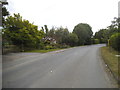
1
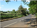
Almners Road, Lyne
A view along Almners Road, Lyne. The Road connects Lyne Lane in the west with Hardwick Lane to the east.
Image: © Alan Hunt
Taken: 28 May 2012
0.02 miles
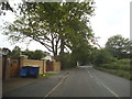
5
Almners Road
The junction of Almners Road with Hardwick Lane.
Image: © Alan Hunt
Taken: 28 May 2012
0.11 miles
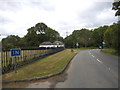
6
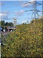
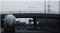
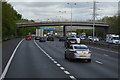
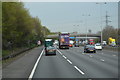
M25 west of Chertsey
looking north-west from Almners Road towards the railway bridge
Image: © Andrew Longton
Taken: 1 Nov 2005
0.14 miles