IMAGES TAKEN NEAR TO
Hawthorn Way, ADDLESTONE, KT15 3NL
Introduction
This page details the photographs taken nearby to Hawthorn Way, KT15 3NL by members of the Geograph project.
The Geograph project started in 2005 with the aim of publishing, organising and preserving representative images for every square kilometre of Great Britain, Ireland and the Isle of Man.

There are currently over 7.5m images from over14,400 individuals and you can help contribute to the project by visiting https://www.geograph.org.uk
Image Map
Images are licensed for reuse under creativecommons.org/licenses/by-sa/2.0
Notes
- Clicking on the map will re-center to the selected point.
- The higher the marker number, the further away the image location is from the centre of the postcode.
Image Listing (12 Images Found)
Images are licensed for reuse under creativecommons.org/licenses/by-sa/2.0
Image
Details
Distance
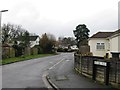
2
Housing development off Mayfield Avenue
Image: © Alex McGregor
Taken: 18 Feb 2014
0.10 miles

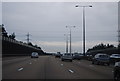
8
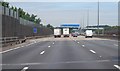
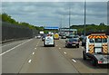
M25 clockwise 1 mile to Junction 11
At Marker 77.5
Image: © Julian P Guffogg
Taken: 7 Aug 2013
0.18 miles