IMAGES TAKEN NEAR TO
Nightingale Rise, Meadowlands, ADDLESTONE, KT15 2GP
Introduction
This page details the photographs taken nearby to Nightingale Rise, Meadowlands, KT15 2GP by members of the Geograph project.
The Geograph project started in 2005 with the aim of publishing, organising and preserving representative images for every square kilometre of Great Britain, Ireland and the Isle of Man.

There are currently over 7.5m images from over14,400 individuals and you can help contribute to the project by visiting https://www.geograph.org.uk
Image Map
Images are licensed for reuse under creativecommons.org/licenses/by-sa/2.0
Notes
- Clicking on the map will re-center to the selected point.
- The higher the marker number, the further away the image location is from the centre of the postcode.
Image Listing (40 Images Found)
Images are licensed for reuse under creativecommons.org/licenses/by-sa/2.0
Image
Details
Distance
1
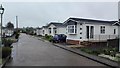
Meadowlands Mobile Home Park - Addlestone
Info : http://www.parkhome-living.co.uk/park-homes-for-sale-and-rent/view/10548-meadowlands-park
Image: © James Emmans
Taken: 10 May 2016
0.04 miles
2
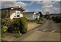
Meadowlands Park
Footpath FP9 runs through the park homes site from the A317 to reach the open flood plain of the Wey shown in Image
Image: © Derek Harper
Taken: 10 May 2013
0.06 miles
3
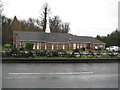
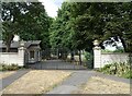
Addlestone: The Church of Jesus Christ of Latter-Day Saints
This modern church on the A317 Weybridge Road occupies the site of the former St Augustine's Church, a tin church built in 1891.
Image: © Nigel Cox
Taken: 10 Feb 2013
0.08 miles
4
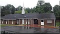
Mormon Church Building - Addlestone
Info http://www.lds.org.uk/
Image: © James Emmans
Taken: 10 May 2016
0.09 miles
5
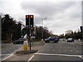
Weybridge Road at the junction of Link Road, Addlestone
Image: © David Howard
Taken: 11 Mar 2013
0.11 miles
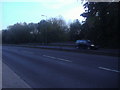
6
Weybridge Road at the junction of Link Road, Addlestone
The entrance to Weybridge Business Park, although the location appears to be well over the River Wey in Addlestone.
Image: © David Howard
Taken: 11 Mar 2013
0.12 miles
7
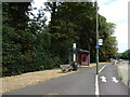
Bus stop and shelter on the A317, Woburn Park
Image: © JThomas
Taken: 25 Jul 2022
0.12 miles
8
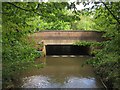
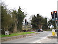
Bridge over The Bourne
Carrying the A317, and seen from a footbridge carrying a path over a short cut that rejoins the river in the foreground.
Image: © Derek Harper
Taken: 10 May 2013
0.12 miles