IMAGES TAKEN NEAR TO
St. Pauls Close, ADDLESTONE, KT15 1RJ
Introduction
This page details the photographs taken nearby to St. Pauls Close, KT15 1RJ by members of the Geograph project.
The Geograph project started in 2005 with the aim of publishing, organising and preserving representative images for every square kilometre of Great Britain, Ireland and the Isle of Man.

There are currently over 7.5m images from over14,400 individuals and you can help contribute to the project by visiting https://www.geograph.org.uk
Image Map
Images are licensed for reuse under creativecommons.org/licenses/by-sa/2.0
Notes
- Clicking on the map will re-center to the selected point.
- The higher the marker number, the further away the image location is from the centre of the postcode.
Image Listing (41 Images Found)
Images are licensed for reuse under creativecommons.org/licenses/by-sa/2.0
Image
Details
Distance
1
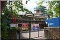
Addlestone
Off the B3121, St Paul's church is undergoing considerable renovation.
Image: © Brendan and Ruth McCartney
Taken: 8 May 2005
0.02 miles
4
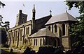
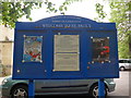
A growing church ?
The church of St Paul has its own small vegetable garden next to it'scar park.
Image: © Anthony Vosper
Taken: 1 Aug 2023
0.04 miles
6
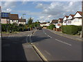
School Lane, Addlestone
This road was in existence prior to 1900 although most of the houses were built in the 1920s. The road was named for the parochial school that was attached to St Paul's church.
Image: © Alan Hunt
Taken: 22 Aug 2012
0.04 miles
8
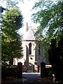
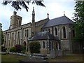
St. Paul's Church
St. Paul's Church, Addlestone, viewed from a little parkland area on the opposite side of School Lane.
Image: © Ajay Tegala
Taken: 20 Sep 2008
0.04 miles
9
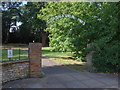
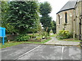
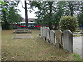
St Paul's graveyard entrance
The entrance arch to the graveyard extension to the east of School Lane commemorating the coronation of Elizabeth II.
Image: © Alan Hunt
Taken: 22 Aug 2012
0.07 miles
10
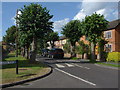
Lime Grove
Lime Grove with the recently pollarded limes that give the road its name.
Image: © Alan Hunt
Taken: 22 Aug 2012
0.10 miles