IMAGES TAKEN NEAR TO
Furze Road, ADDLESTONE, KT15 1DP
Introduction
This page details the photographs taken nearby to Furze Road, KT15 1DP by members of the Geograph project.
The Geograph project started in 2005 with the aim of publishing, organising and preserving representative images for every square kilometre of Great Britain, Ireland and the Isle of Man.

There are currently over 7.5m images from over14,400 individuals and you can help contribute to the project by visiting https://www.geograph.org.uk
Image Map
Images are licensed for reuse under creativecommons.org/licenses/by-sa/2.0
Notes
- Clicking on the map will re-center to the selected point.
- The higher the marker number, the further away the image location is from the centre of the postcode.
Image Listing (19 Images Found)
Images are licensed for reuse under creativecommons.org/licenses/by-sa/2.0
Image
Details
Distance
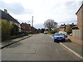
2
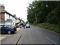
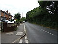
Hare Hill Junction with Row Hill - Row Town
Image: © James Emmans
Taken: 10 May 2016
0.11 miles
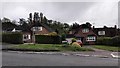
5
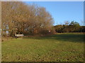
Hare Hill recreation area
A seat at the top of the open area next to Hare Hill
Image: © Alan Hunt
Taken: 15 Jan 2012
0.13 miles
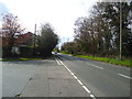
7
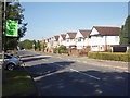
Hare Hill
Hare Hill, Row Hill, Addlestone.
Image: © Ajay Tegala
Taken: 20 Sep 2008
0.16 miles
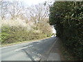
10
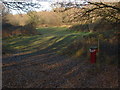
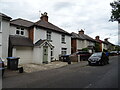
Hare Hill recreation area
The exit from the woods to the open area near Hare Hill
Image: © Alan Hunt
Taken: 15 Jan 2012
0.18 miles