IMAGES TAKEN NEAR TO
Mowbray Avenue, WEST BYFLEET, KT14 7PF
Introduction
This page details the photographs taken nearby to Mowbray Avenue, KT14 7PF by members of the Geograph project.
The Geograph project started in 2005 with the aim of publishing, organising and preserving representative images for every square kilometre of Great Britain, Ireland and the Isle of Man.

There are currently over 7.5m images from over14,400 individuals and you can help contribute to the project by visiting https://www.geograph.org.uk
Image Map
Images are licensed for reuse under creativecommons.org/licenses/by-sa/2.0
Notes
- Clicking on the map will re-center to the selected point.
- The higher the marker number, the further away the image location is from the centre of the postcode.
Image Listing (22 Images Found)
Images are licensed for reuse under creativecommons.org/licenses/by-sa/2.0
Image
Details
Distance
1
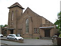
Byfleet Methodist Church
The Church is on the east side of Rectory Lane.
(NB From a Geograph point of view the OS 1:10,000 scale mapping shows the National Grid Northing line at 161000 passes through the church somewhere near the tower, but most of what you see is in this square Image)
Image: © Nigel Cox
Taken: 20 May 2008
0.07 miles
2
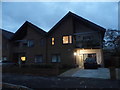
Modern houses on Rectory Lane, Byfleet
Modern is actually a style going back to the turn of the 19th century originating in Germany, and is rare to have any built nowadays like these three.
Image: © David Howard
Taken: 8 Nov 2015
0.09 miles
3
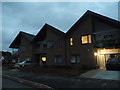
Modern houses on Rectory Lane, Byfleet
There are more behind them on the new road.
Image: © David Howard
Taken: 8 Nov 2015
0.10 miles
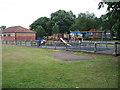
5

St Mary the Virgin, Byfleet
Grade 1 listed building erected in the 13th century.
Image: © Michael FORD
Taken: Unknown
0.10 miles
6
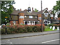
Byfleet: The Village Hall
As village halls go this one is quite magnificent! It was built to commemorate the Diamond Jubilee, in 1897, of Queen Victoria's reign, but was actually opened in 1898. The half-timbered building has castellated towers either side of the entrance, and a clock turret and cupola. It is on the south side of the High Road.
Image: © Nigel Cox
Taken: 20 May 2008
0.11 miles
7
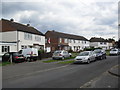
Hart Road
1950s council houses in Byfleet.
Image: © Burgess Von Thunen
Taken: 20 Jun 2012
0.14 miles
8
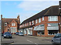
High Road, Byfleet
Really a High Street with village centre shops and a bank on a service road off the main roadway.
http://www.british-history.ac.uk/report.aspx?compid=42996
Image: © Colin Smith
Taken: 6 Mar 2011
0.15 miles
9
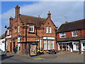
Lloyds TSB, Byfleet
Striking red brick building on the High road in central Byfleet.
http://www.british-history.ac.uk/report.aspx?compid=42996
Image: © Colin Smith
Taken: 6 Mar 2011
0.16 miles