IMAGES TAKEN NEAR TO
Bruce Close, WEST BYFLEET, KT14 7ND
Introduction
This page details the photographs taken nearby to Bruce Close, KT14 7ND by members of the Geograph project.
The Geograph project started in 2005 with the aim of publishing, organising and preserving representative images for every square kilometre of Great Britain, Ireland and the Isle of Man.

There are currently over 7.5m images from over14,400 individuals and you can help contribute to the project by visiting https://www.geograph.org.uk
Image Map
Images are licensed for reuse under creativecommons.org/licenses/by-sa/2.0
Notes
- Clicking on the map will re-center to the selected point.
- The higher the marker number, the further away the image location is from the centre of the postcode.
Image Listing (47 Images Found)
Images are licensed for reuse under creativecommons.org/licenses/by-sa/2.0
Image
Details
Distance
1
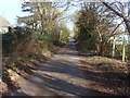
Murray Lane, Byfleet
The short surfaced section of Murray Lane looking towards the junction with Rectory Lane.
Image: © Alan Hunt
Taken: 5 Mar 2013
0.05 miles
2
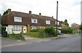
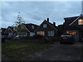
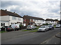
Byfleet: Rectory Lane and Bruce Close
The houses seen here in Rectory Lane, and beyond in Bruce Close, demonstrate an unusual but briefly popular method of residential construction using pre-cast concrete panels with near-vertical hung tiles forming the exterior covering of the upper floors.
Image: © Nigel Cox
Taken: 20 May 2008
0.06 miles
3
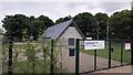
The New Byfleet Scouts Hut and Grounds
Info : http://www.1stbyfleet.org.uk/
Image: © James Emmans
Taken: 19 May 2016
0.07 miles
4
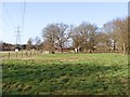
Fields near Byfleet
The fields to the east on the M25 from Murray Lane.
Image: © Alan Hunt
Taken: 5 Mar 2013
0.07 miles
6
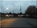
Winern Glebe, Byfleet
Apart from the M25 (which wasn't here till relatively recently) this is the only public road in TQ0560
Image: © David Howard
Taken: 8 Nov 2015
0.11 miles
9
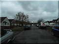
Hart Road
1950s council houses in Byfleet.
Image: © Burgess Von Thunen
Taken: 20 Jun 2012
0.13 miles
10
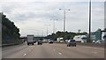
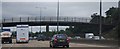
M25 anticlockwise (eastbound)
At Marker 75.3
Image: © Julian P Guffogg
Taken: 13 Aug 2013
0.13 miles