IMAGES TAKEN NEAR TO
Woodlands Road, WEST BYFLEET, KT14 6JW
Introduction
This page details the photographs taken nearby to Woodlands Road, KT14 6JW by members of the Geograph project.
The Geograph project started in 2005 with the aim of publishing, organising and preserving representative images for every square kilometre of Great Britain, Ireland and the Isle of Man.

There are currently over 7.5m images from over14,400 individuals and you can help contribute to the project by visiting https://www.geograph.org.uk
Image Map
Images are licensed for reuse under creativecommons.org/licenses/by-sa/2.0
Notes
- Clicking on the map will re-center to the selected point.
- The higher the marker number, the further away the image location is from the centre of the postcode.
Image Listing (19 Images Found)
Images are licensed for reuse under creativecommons.org/licenses/by-sa/2.0
Image
Details
Distance
1
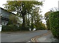
Looking from Hollybank Road into Oakcroft Road
Image: © Basher Eyre
Taken: 30 Oct 2020
0.09 miles
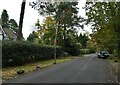
2
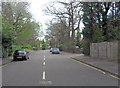
Oakcroft Road
Further south this road is called Coldharbour Road.
Image: © Stuart Logan
Taken: 20 Apr 2012
0.10 miles
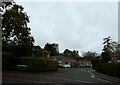
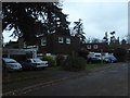
4
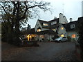
Oakcroft House, Pyrford
A private care home
Image: © David Howard
Taken: 8 Nov 2015
0.11 miles
5
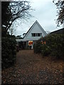
Modern house on Oakcroft Road
This style was all the rage in the 60s and 70s, based on the Scandinavian style to stop the snow settling on the roof.
Image: © David Howard
Taken: 8 Nov 2015
0.13 miles
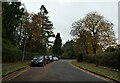
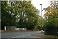
6
Looking from Oakcroft Road into Trevose Avenue
Image: © Basher Eyre
Taken: 30 Oct 2020
0.13 miles
8
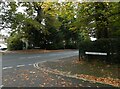
Looking from Woodlands Road, across the B382 towards Fairford Close
Image: © Basher Eyre
Taken: 30 Oct 2020
0.14 miles
9
Modern houses on Oakcroft Close, West Byfleet
Image: © David Howard
Taken: 8 Nov 2015
0.15 miles
10
Looking from Coldharbour Road into Old Woking Road
Image: © Basher Eyre
Taken: 30 Oct 2020
0.16 miles