IMAGES TAKEN NEAR TO
Wey Meadows, WEYBRIDGE, KT13 8XY

Introduction

This page details the photographs taken nearby to Wey Meadows, KT13 8XY by members of the Geograph project.

The Geograph project started in 2005 with the aim of publishing, organising and preserving representative images for every square kilometre of Great Britain, Ireland and the Isle of Man.

There are currently over 7.5m images from over14,400 individuals and you can help contribute to the project by visiting https://www.geograph.org.uk

Image Map


Images are licensed for reuse under creativecommons.org/licenses/by-sa/2.0
Notes
  • Clicking on the map will re-center to the selected point.
  • The higher the marker number, the further away the image location is from the centre of the postcode.

Image Listing (63 Images Found)

Images are licensed for reuse under creativecommons.org/licenses/by-sa/2.0
  • ...
Image
Details
Distance
1
Wey Meadows Chalet Park
The Wey Meadows Chalet Park near Hamm Moor.
Image: © Alan Hunt Taken: 26 May 2016
0.04 miles
2
Railway lines near Addlestone
The railway lines looking towards Addlestone with the former mill buildings on the River Wey Navigation.
Image: © Alan Hunt Taken: 26 May 2016
0.08 miles
3
Railway at Wey Meadows
Looking in the other direction from the same crossing as Image The pair of dark parapets where the line crosses the River Wey 100 metres away can just be made out.
Image: © Derek Harper Taken: 10 May 2013
0.10 miles
4
Stile below the railway line
After crossing the railway (see Image]), Runnymede footpath 11 drops down the embankment to cross this stile and curve around an abandoned meander of the Wey.
Image: © Derek Harper Taken: 10 May 2013
0.10 miles
5
Approaching Addlestone
An Addlestone bound train near the pedestrian crossing point on the footpath to Weybridge.
Image: © Alan Hunt Taken: 26 May 2016
0.11 miles
6
Footpath to Weybridge
The footpath from the Byfleet Road to Weybridge approaching the railway crossing point north of the Addlestone Junction.
Image: © Alan Hunt Taken: 26 May 2016
0.11 miles
7
Railway at Wey Meadows
Looking along the track from the crossing for Runnymede footpath 11 to where the line crosses the River Wey Navigation near Coxes Lock. Some of the mill buildings shown in http://www.geograph.org.uk/gridref/TQ0664?centi=TQ061641 can be seen.
Image: © Derek Harper Taken: 10 May 2013
0.12 miles
8
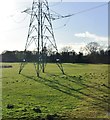
Pylon, Wey floodplain
Image: © N Chadwick Taken: 10 Mar 2019
0.12 miles
9
Railway bridge by Cox's Mill
Image: © Robert Eva Taken: 21 Apr 2017
0.13 miles
10
Coxes Mill
The former grain store of Coxes Mill, now converted to apartments.
Image: © Graham Horn Taken: 24 Aug 2008
0.13 miles
  • ...