1
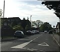
Ambleside Avenue, Walton-on-Thames
Mini-roundabout on Ambleside Avenue.
Image: © Daniel Parks
Taken: 3 May 2018
0.07 miles
2
Walton-on-Thames: Former Ambleside Junior School (2)
Please see
Image for details.
Image: © Nigel Cox
Taken: 13 Aug 2008
0.08 miles
3
Walton-on-Thames: Former Swansmere Infants School
Photographed for the record this is the former Swansmere Infants School, now in a derelict state after closure around 2004, when the school amalgamated with Ambleside Junior School to form the new Walton Oak Primary School. The closure appears to have become necessary as both Swansmere and Ambleside were suffering from undersubscribed numbers of children.
Image: © Nigel Cox
Taken: 13 Aug 2008
0.08 miles
4
Walton-on-Thames: Former Ambleside Junior School (1)
Photographed for the record this is the former Ambleside Junior School, now in a disused state after closure around 2004, when the school amalgamated with Swansmere Infants School to form the new Walton Oak Primary School. The closure appears to have become necessary as both Swansmere and Ambleside were suffering from undersubscribed numbers of children. The access road to the new school is in the foreground. Ambleside Junior School dates from the 1920s or early 1930s.
Image: © Nigel Cox
Taken: 13 Aug 2008
0.11 miles
5
Walton-on-Thames: St John's Church
St John's Church is in the Parish of Walton-on-Thames and was built in the Furrows in 1953 to serve the community in the south and east of the parish. Its page on the Parish website is here http://www.waltonparish.org.uk/St_Johns.html
Image: © Nigel Cox
Taken: 13 Aug 2008
0.12 miles
6
Walton-on-Thames: The Furrows
The broad expanse of an estate road in the Rydens area of Walton-on-Thames, probably named after its former agricultural use. The Ordnance Survey map of 1938 shows the road layout and names but the 1919 edition shows only the original field layout.
Image: © Nigel Cox
Taken: 13 Aug 2008
0.13 miles
7
Dry ditch by Cottimore Lane
Beyond the fence are fields of Walton Oak School.
Image: © Robin Webster
Taken: 1 Sep 2012
0.18 miles
8
Cottimore Lane and dirty ditch junction
This part of Cottimore Lane, the older part, is now just a path running behind suburban gardens.
Image: © Robin Webster
Taken: 1 Sep 2012
0.20 miles
9
Cottimore Lane
This part of Cottimore Lane, the older part, is now just a path running behind suburban gardens.
Image: © Robin Webster
Taken: 1 Sep 2012
0.20 miles
10
Ditch by Cottimore Lane
This part of Cottimore Lane, the older part, is now just a path running behind suburban gardens.
Image: © Robin Webster
Taken: 1 Sep 2012
0.20 miles


