IMAGES TAKEN NEAR TO
Rydens Road, WALTON-ON-THAMES, KT12 3AP
Introduction
This page details the photographs taken nearby to Rydens Road, KT12 3AP by members of the Geograph project.
The Geograph project started in 2005 with the aim of publishing, organising and preserving representative images for every square kilometre of Great Britain, Ireland and the Isle of Man.

There are currently over 7.5m images from over14,400 individuals and you can help contribute to the project by visiting https://www.geograph.org.uk
Image Map
Images are licensed for reuse under creativecommons.org/licenses/by-sa/2.0
Notes
- Clicking on the map will re-center to the selected point.
- The higher the marker number, the further away the image location is from the centre of the postcode.
Image Listing (18 Images Found)
Images are licensed for reuse under creativecommons.org/licenses/by-sa/2.0
Image
Details
Distance
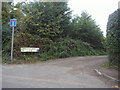
4
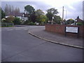
Corner of Holly Avenue and Rydens Road
Image: © David Howard
Taken: 17 Oct 2011
0.06 miles
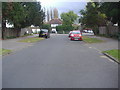
6
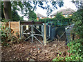
Substation, Cottimore Lane
This part of Cottimore Lane, the older part, is now just a path running behind suburban gardens.
Image: © Robin Webster
Taken: 1 Sep 2012
0.11 miles

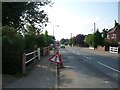
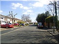
8
Cottimore Lane
This part of Cottimore Lane, the older part, is now just a path running behind suburban gardens.
Image: © Robin Webster
Taken: 1 Sep 2012
0.14 miles
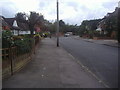
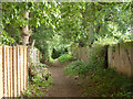
9
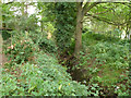
Ditch by Cottimore Lane
This part of Cottimore Lane, the older part, is now just a path running behind suburban gardens.
Image: © Robin Webster
Taken: 1 Sep 2012
0.18 miles