IMAGES TAKEN NEAR TO
Second Avenue, WALTON-ON-THAMES, KT12 2HW
Introduction
This page details the photographs taken nearby to Second Avenue, KT12 2HW by members of the Geograph project.
The Geograph project started in 2005 with the aim of publishing, organising and preserving representative images for every square kilometre of Great Britain, Ireland and the Isle of Man.

There are currently over 7.5m images from over14,400 individuals and you can help contribute to the project by visiting https://www.geograph.org.uk
Image Map
Images are licensed for reuse under creativecommons.org/licenses/by-sa/2.0
Notes
- Clicking on the map will re-center to the selected point.
- The higher the marker number, the further away the image location is from the centre of the postcode.
Image Listing (19 Images Found)
Images are licensed for reuse under creativecommons.org/licenses/by-sa/2.0
Image
Details
Distance
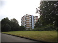
1
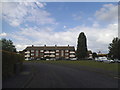
Flats on Carlton Road, Walton on Thames
Image: © David Howard
Taken: 13 Jul 2014
0.08 miles
2
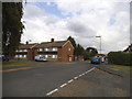
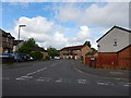
Sandy Lane at the junction of Carlton Road
Image: © David Howard
Taken: 13 Jul 2014
0.11 miles
3
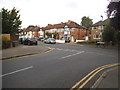
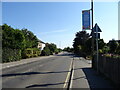
The Grove at the junction of Carlton Road
Image: © David Howard
Taken: 13 Jul 2014
0.16 miles
4
Vanborough Drive Junction with Telford Drive
Image: © James Emmans
Taken: 22 May 2016
0.16 miles
5
The Grove at the junction of Carlton Road
Image: © David Howard
Taken: 13 Jul 2014
0.16 miles
7
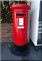
Elizabeth II postbox on Terrace Road, Walton-on-Thames
Postbox No. KT12 110.
See Image] for context.
Image: © JThomas
Taken: 29 Jul 2022
0.18 miles
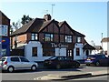
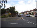
8
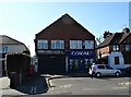
Shops on Terrace Road, Walton-on-Thames
Showing position of Postbox No. KT12 110.
See Image] for postbox.
Image: © JThomas
Taken: 29 Jul 2022
0.19 miles
9
Flats on Vanbrugh Drive, Walton on Thames
Image: © David Howard
Taken: 13 Jul 2014
0.19 miles