IMAGES TAKEN NEAR TO
Blundel Lane, COBHAM, KT11 2SY
Introduction
This page details the photographs taken nearby to Blundel Lane, KT11 2SY by members of the Geograph project.
The Geograph project started in 2005 with the aim of publishing, organising and preserving representative images for every square kilometre of Great Britain, Ireland and the Isle of Man.

There are currently over 7.5m images from over14,400 individuals and you can help contribute to the project by visiting https://www.geograph.org.uk
Image Map
Images are licensed for reuse under creativecommons.org/licenses/by-sa/2.0
Notes
- Clicking on the map will re-center to the selected point.
- The higher the marker number, the further away the image location is from the centre of the postcode.
Image Listing (16 Images Found)
Images are licensed for reuse under creativecommons.org/licenses/by-sa/2.0
Image
Details
Distance
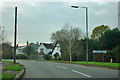
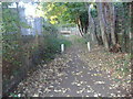
1
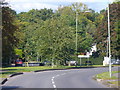
Entering Oxshott
On Blundel Lane, approaching the very leafy and upmarket village of Oxshott.
Image: © Colin Smith
Taken: 17 Oct 2010
0.04 miles
2
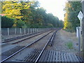
Railway northbound from Blundel Lane level crossing
Image: © David Howard
Taken: 19 Oct 2009
0.06 miles
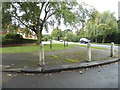
3
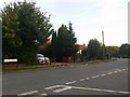
Blundel Lane, Oxshott
At the end of Littleheath Lane
Image: © David Howard
Taken: 28 Aug 2017
0.06 miles
4
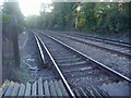
Railway lines south of level crossing, Littleheath Lane
Image: © David Howard
Taken: 19 Oct 2009
0.06 miles
5
Level crossing at Blundel Lane
Looking north.
Image: © Andrew Longton
Taken: 8 Sep 2005
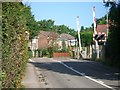
0.07 miles
6
Entering Stoke D'Abernon
On the road from Oxshott.
Image: © Robin Webster
Taken: 21 Nov 2011
0.07 miles
7
Kenilworth Avenue at the junction of Steel's Lane
Image: © David Howard
Taken: 1 Sep 2014
0.08 miles
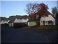
10
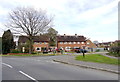
Houses on Waverley Road
These houses at the junction of Waverley Road and Blundells Lane which can be seen in the foreground appear to be social housing or ex social housing, i.e. former council houses. They are mostly semi-detached.
Image: © Nigel Mykura
Taken: 17 Apr 2015
0.12 miles