IMAGES TAKEN NEAR TO
Blundel Lane, COBHAM, KT11 2SN
Introduction
This page details the photographs taken nearby to Blundel Lane, KT11 2SN by members of the Geograph project.
The Geograph project started in 2005 with the aim of publishing, organising and preserving representative images for every square kilometre of Great Britain, Ireland and the Isle of Man.

There are currently over 7.5m images from over14,400 individuals and you can help contribute to the project by visiting https://www.geograph.org.uk
Image Map
Images are licensed for reuse under creativecommons.org/licenses/by-sa/2.0
Notes
- Clicking on the map will re-center to the selected point.
- The higher the marker number, the further away the image location is from the centre of the postcode.
Image Listing (12 Images Found)
Images are licensed for reuse under creativecommons.org/licenses/by-sa/2.0
Image
Details
Distance
1
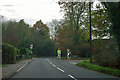
Riding on Blundel Lane
The sign warns of the possibility of flooding.
Image: © Robin Webster
Taken: 21 Nov 2011
0.02 miles
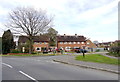
2
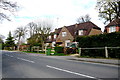
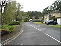
Houses on Blundell Lane
Blundell lane runs from Stoke D'abernon north to Oxshott.It is a very leafy and suburban lane but has expensive detached houses at its northern and southern ends such as these ones near Oxshott.
Image: © Nigel Mykura
Taken: 17 Apr 2015
0.02 miles
3
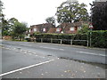
Blundel Lane at the junction of Randolph Close
Image: © David Howard
Taken: 1 Sep 2014
0.03 miles
4
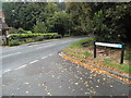
Randolph Close at the junction of Blundel Lane
Image: © David Howard
Taken: 1 Sep 2014
0.04 miles
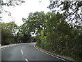
6
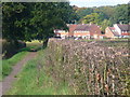
Footpath to Oxshott
Good going on the clay path towards Blundel Lane. The hedgerow has been recently trimmed.
Image: © Colin Smith
Taken: 17 Oct 2010
0.12 miles
7
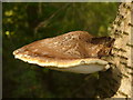
Sucker
Bracket fungus growing on the side of a birch tree in The Furze, Oxshott. This is one of several fungi on the same tree and it has grown out about 1 foot from the trunk.
Image: © Colin Smith
Taken: 17 Oct 2010
0.14 miles
8
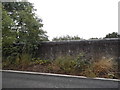
Railway bridge on Blundel Lane, Stoke D'Abernon
Image: © David Howard
Taken: 1 Sep 2014
0.19 miles
9
Houses on Waverley Road
These houses at the junction of Waverley Road and Blundells Lane which can be seen in the foreground appear to be social housing or ex social housing, i.e. former council houses. They are mostly semi-detached.
Image: © Nigel Mykura
Taken: 17 Apr 2015
0.22 miles
10
Blundel Lane, Stoke D'Abernon
About to cross the railway bridge
Image: © David Howard
Taken: 1 Sep 2014
0.22 miles