IMAGES TAKEN NEAR TO
Kimberley Ride, COBHAM, KT11 2QD
Introduction
This page details the photographs taken nearby to Kimberley Ride, KT11 2QD by members of the Geograph project.
The Geograph project started in 2005 with the aim of publishing, organising and preserving representative images for every square kilometre of Great Britain, Ireland and the Isle of Man.

There are currently over 7.5m images from over14,400 individuals and you can help contribute to the project by visiting https://www.geograph.org.uk
Image Map
Images are licensed for reuse under creativecommons.org/licenses/by-sa/2.0
Notes
- Clicking on the map will re-center to the selected point.
- The higher the marker number, the further away the image location is from the centre of the postcode.
Image Listing (14 Images Found)
Images are licensed for reuse under creativecommons.org/licenses/by-sa/2.0
Image
Details
Distance
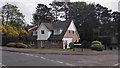
1
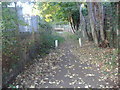
Little Heath Lane
In the commuting village of Fairmile, Cobham, next to Oxshott Heath.
Image: © Colin Smith
Taken: 17 Oct 2010
0.15 miles
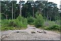
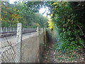
2
The New Line by Oxshott Heath
The New Line is mainly a line for commuters. It parallels the main line between Guildford and London for its Guildford-Surbiton stretch.
Image: © Colin Smith
Taken: 17 Oct 2010
0.17 miles
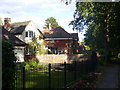
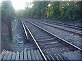
6
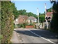
Level crossing at Blundel Lane
Looking north.
Image: © Andrew Longton
Taken: 8 Sep 2005
0.21 miles
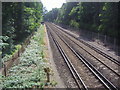
7
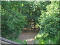
Oxshott Heath
Taken from the railway bridge above
Image: © David Howard
Taken: 16 Jun 2008
0.21 miles
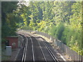
8
Railway lines south of level crossing, Littleheath Lane
Image: © David Howard
Taken: 19 Oct 2009
0.22 miles