IMAGES TAKEN NEAR TO
Birch Grove, COBHAM, KT11 2HR
Introduction
This page details the photographs taken nearby to Birch Grove, KT11 2HR by members of the Geograph project.
The Geograph project started in 2005 with the aim of publishing, organising and preserving representative images for every square kilometre of Great Britain, Ireland and the Isle of Man.

There are currently over 7.5m images from over14,400 individuals and you can help contribute to the project by visiting https://www.geograph.org.uk
Image Map
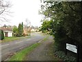
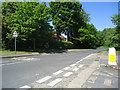
Images are licensed for reuse under creativecommons.org/licenses/by-sa/2.0
Notes
- Clicking on the map will re-center to the selected point.
- The higher the marker number, the further away the image location is from the centre of the postcode.
Image Listing (24 Images Found)
Images are licensed for reuse under creativecommons.org/licenses/by-sa/2.0
Image
Details
Distance
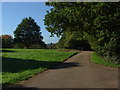
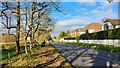
3
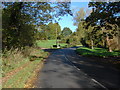
Leigh Hill Road
Leigh Hill Road with Leigh Hill on the left.
Image: © Alan Hunt
Taken: 24 Oct 2010
0.15 miles
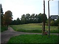
5
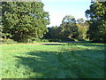
Leigh Hill, Cobham
The small open area of Leigh Hill, tucked away among the (very) expensive estates of Cobham
Image: © Alan Hunt
Taken: 24 Oct 2010
0.18 miles
6
Leigh Hill, Cobham
The track along the top of the hill.
Image: © Alan Hunt
Taken: 24 Oct 2010
0.18 miles
7
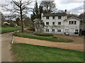
Leigh Hill Hall
Leigh Hill Hall (15a Leigh Hill Road) faces on to Leigh Hill common: the drive and grassland in the foreground is common land, and subject to a public right of access (and the corresponding order of limitation).
Image: © Hugh Craddock
Taken: 17 Mar 2020
0.19 miles
8
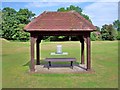
Memorial Plaque : Tilt Common
A memorial plaque was unveiled at the Avenue of Remembrance to remember those who lost their lives in the Second World War on the 26th April 2009. The plaque stands opposite Tilt Green, refer to picture Image
Image: © Len Williams
Taken: 4 Aug 2014
0.20 miles
9
Riverside houses on Mill Road
The path is used as part of the new walking resource website route 'coblea two'.
Sloways https://beta.slowways.org/Route/Coblea/9006
Image: © James Emmans
Taken: 18 Nov 2021
0.20 miles
10
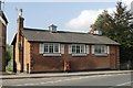
Cobham old fire station
Cobham old fire station, Tilt Road, Cobham, Surrey, now converted into a domestic dwelling
Image: © Kevin Hale
Taken: 6 Oct 2007
0.21 miles