IMAGES TAKEN NEAR TO
Portsmouth Road, COBHAM, KT11 1BL
Introduction
This page details the photographs taken nearby to Portsmouth Road, KT11 1BL by members of the Geograph project.
The Geograph project started in 2005 with the aim of publishing, organising and preserving representative images for every square kilometre of Great Britain, Ireland and the Isle of Man.

There are currently over 7.5m images from over14,400 individuals and you can help contribute to the project by visiting https://www.geograph.org.uk
Image Map
Images are licensed for reuse under creativecommons.org/licenses/by-sa/2.0
Notes
- Clicking on the map will re-center to the selected point.
- The higher the marker number, the further away the image location is from the centre of the postcode.
Image Listing (9 Images Found)
Images are licensed for reuse under creativecommons.org/licenses/by-sa/2.0
Image
Details
Distance
1
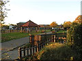
The ACS International School Campus, Cobham
ACS have schools here, and in Egham and Hillingdon plus one in Doha, Qatar.
Image: © David Howard
Taken: 11 Nov 2012
0.03 miles
2
The ACS International School Campus, Cobham
Image: © David Howard
Taken: 11 Nov 2012
0.03 miles
3
The ACS International School Campus looking towards Heywood Lodge
Image: © David Howard
Taken: 11 Nov 2012
0.04 miles
4
Heywood Lodge on the ACS International School campus
Image: © David Howard
Taken: 11 Nov 2012
0.06 miles
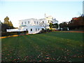
5
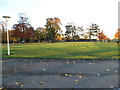
Lawn on the ACS International School campus, Cobham
Image: © David Howard
Taken: 11 Nov 2012
0.06 miles
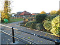
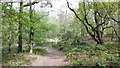
6
Bridleway on Fairmile Common
The American Community School Cobham http://www.acs-england.co.uk/schools/cobham/index.htm is to the left.
Image: © Roger Miller
Taken: 4 Dec 2005
0.13 miles
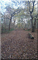
8
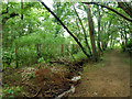
Stream and path, Winterdown Wood
The fence on the left marks the limit of the publicly accessible area of the wood. At the end of the straight on the path is the River Mole, where the path turns right to follow its bank.
Image: © Robin Webster
Taken: 24 Aug 2012
0.24 miles
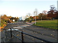
9
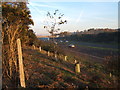
A3 near the American Community School, Cobham
Looking east from the top of the embankment.
Image: © Roger Miller
Taken: 19 Nov 2005
0.25 miles