IMAGES TAKEN NEAR TO
High Foleys, ESHER, KT10 0UA
Introduction
This page details the photographs taken nearby to High Foleys, KT10 0UA by members of the Geograph project.
The Geograph project started in 2005 with the aim of publishing, organising and preserving representative images for every square kilometre of Great Britain, Ireland and the Isle of Man.

There are currently over 7.5m images from over14,400 individuals and you can help contribute to the project by visiting https://www.geograph.org.uk
Image Map
Images are licensed for reuse under creativecommons.org/licenses/by-sa/2.0
Notes
- Clicking on the map will re-center to the selected point.
- The higher the marker number, the further away the image location is from the centre of the postcode.
Image Listing (26 Images Found)
Images are licensed for reuse under creativecommons.org/licenses/by-sa/2.0
Image
Details
Distance
1
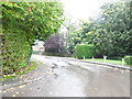
Ruxley Ridge, Claygate
Not a good day for taking photos as you can see
Image: © David Howard
Taken: 21 Oct 2012
0.12 miles
2
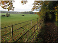
Barwell Court Farm
The section separated from the farm buildings by the A3. Also the bridleway to Claygate.
Image: © Hugh Venables
Taken: 6 Nov 2010
0.12 miles
3
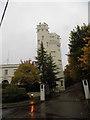
Ruxley Tower, Claygate
Part of a small stately home seen on the left.
Image: © David Howard
Taken: 21 Oct 2012
0.12 miles
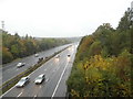
4
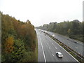
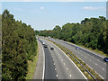
The A3 heading towards London in Claygate
Image: © David Howard
Taken: 21 Oct 2012
0.14 miles
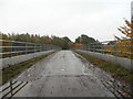
6
A3 bridge
Carrying a bridleway and connecting the farmland each side of the A3.
Image: © Hugh Venables
Taken: 6 Nov 2010
0.15 miles
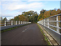
7
A3(T) from the bridleway bridge near Barwell Farm
Looking northeast.
Image: © Roger Miller
Taken: 29 Aug 2005
0.15 miles
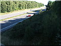
9
A3 towards London
The Greater London boundary with Surrey runs along the right hand side of the road, with Surrey on the left.
Image: © Robin Webster
Taken: 3 Sep 2012
0.17 miles
10
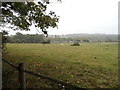
Fields on Barwell Court Farm, Claygate
Image: © David Howard
Taken: 21 Oct 2012
0.17 miles