IMAGES TAKEN NEAR TO
Skye Road, PRESTWICK, KA9 2TA
Introduction
This page details the photographs taken nearby to Skye Road, KA9 2TA by members of the Geograph project.
The Geograph project started in 2005 with the aim of publishing, organising and preserving representative images for every square kilometre of Great Britain, Ireland and the Isle of Man.

There are currently over 7.5m images from over14,400 individuals and you can help contribute to the project by visiting https://www.geograph.org.uk
Image Map
Images are licensed for reuse under creativecommons.org/licenses/by-sa/2.0
Notes
- Clicking on the map will re-center to the selected point.
- The higher the marker number, the further away the image location is from the centre of the postcode.
Image Listing (46 Images Found)
Images are licensed for reuse under creativecommons.org/licenses/by-sa/2.0
Image
Details
Distance
1

Asbestos Analytical Services - Prestwick
Analysis and disposal of unwanted asbestos products
Image: © Ian Rainey
Taken: 27 Jun 2019
0.07 miles
4
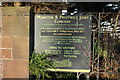
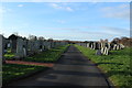
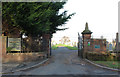
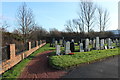
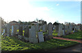
Monkton & Prestwick Joint Cemetery Sign
Image: © Billy McCrorie
Taken: 29 Dec 2016
0.09 miles
8

Atlas Van Tech - Prestwick
Provides custom shelving and rack systems for van interiors and exteriors
Image: © Ian Rainey
Taken: 27 Jun 2019
0.10 miles