IMAGES TAKEN NEAR TO
Duke Terrace, AYR, KA8 8JA
Introduction
This page details the photographs taken nearby to Duke Terrace, KA8 8JA by members of the Geograph project.
The Geograph project started in 2005 with the aim of publishing, organising and preserving representative images for every square kilometre of Great Britain, Ireland and the Isle of Man.

There are currently over 7.5m images from over14,400 individuals and you can help contribute to the project by visiting https://www.geograph.org.uk
Image Map
Images are licensed for reuse under creativecommons.org/licenses/by-sa/2.0
Notes
- Clicking on the map will re-center to the selected point.
- The higher the marker number, the further away the image location is from the centre of the postcode.
Image Listing (180 Images Found)
Images are licensed for reuse under creativecommons.org/licenses/by-sa/2.0
Image
Details
Distance
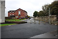

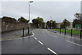
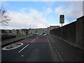
5
Near Viewfield Road
From the junction with Viewfield Road.
Image: © Billy McCrorie
Taken: 15 Feb 2012
0.06 miles
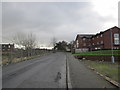
7
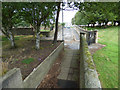
Russell Street
A narrow, dead end street, between two graveyards.
Image: © Thomas Nugent
Taken: 3 Aug 2018
0.07 miles
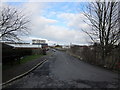
9
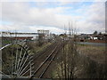
Railway Line
From the bridge near Hawkhill Avenue.
Image: © Billy McCrorie
Taken: 15 Feb 2012
0.07 miles
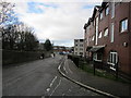
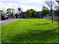
10
Russell Drive
From the junction with King Street.
Image: © Billy McCrorie
Taken: 15 Feb 2012
0.07 miles