IMAGES TAKEN NEAR TO
Hayhill, AYR, KA8 0SH
Introduction
This page details the photographs taken nearby to Hayhill, KA8 0SH by members of the Geograph project.
The Geograph project started in 2005 with the aim of publishing, organising and preserving representative images for every square kilometre of Great Britain, Ireland and the Isle of Man.

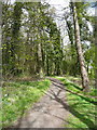
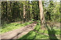
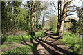
There are currently over 7.5m images from over14,400 individuals and you can help contribute to the project by visiting https://www.geograph.org.uk
Image Map
Images are licensed for reuse under creativecommons.org/licenses/by-sa/2.0
Notes
- Clicking on the map will re-center to the selected point.
- The higher the marker number, the further away the image location is from the centre of the postcode.
Image Listing (57 Images Found)
Images are licensed for reuse under creativecommons.org/licenses/by-sa/2.0
Image
Details
Distance
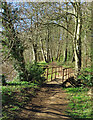
3
Riverside Path approaching Footbridge
Image: © Billy McCrorie
Taken: 27 Apr 2018
0.10 miles

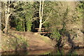
5
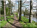
Riverside path approaching the end of the woodland, Craigie Estate, Ayr
Image: © Humphrey Bolton
Taken: 1 May 2013
0.10 miles
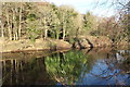
6
A footbridge on the River Ayr Walk
The bridge crosses a small burn near Dalmilling Golf Course.
Image: © Mary and Angus Hogg
Taken: 22 Feb 2023
0.10 miles

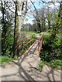
8
Footbridge by the River Ayr
See bridge from the other bank Image
Image: © Billy McCrorie
Taken: 10 Jan 2018
0.10 miles
9
Footbridge by the River Ayr
See footbridge from the other bank Image
Image: © Billy McCrorie
Taken: 10 Jan 2018
0.10 miles
10
Footbridge on the riverside path, Ayr
Image: © Humphrey Bolton
Taken: 1 May 2013
0.10 miles