IMAGES TAKEN NEAR TO
Chapelton Crescent, AYR, KA7 4US
Introduction
This page details the photographs taken nearby to Chapelton Crescent, KA7 4US by members of the Geograph project.
The Geograph project started in 2005 with the aim of publishing, organising and preserving representative images for every square kilometre of Great Britain, Ireland and the Isle of Man.

There are currently over 7.5m images from over14,400 individuals and you can help contribute to the project by visiting https://www.geograph.org.uk
Image Map
Images are licensed for reuse under creativecommons.org/licenses/by-sa/2.0
Notes
- Clicking on the map will re-center to the selected point.
- The higher the marker number, the further away the image location is from the centre of the postcode.
Image Listing (20 Images Found)
Images are licensed for reuse under creativecommons.org/licenses/by-sa/2.0
Image
Details
Distance
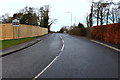
4
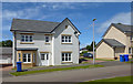
Doonholm Meadows
Prestigious new housing area on the south side of Ayr.
Image: © Mary and Angus Hogg
Taken: 20 May 2016
0.09 miles
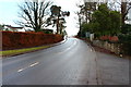
5
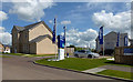
New Houses at Doonholm Meadows
Prestigious new housing area on the south side of Ayr, advertised by the builder as the place to find your dream home.
Image: © Mary and Angus Hogg
Taken: 20 May 2016
0.09 miles