IMAGES TAKEN NEAR TO
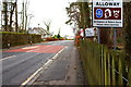
Alloway, AYR, KA7 4NL
Introduction
This page details the photographs taken nearby to Alloway, KA7 4NL by members of the Geograph project.
The Geograph project started in 2005 with the aim of publishing, organising and preserving representative images for every square kilometre of Great Britain, Ireland and the Isle of Man.

There are currently over 7.5m images from over14,400 individuals and you can help contribute to the project by visiting https://www.geograph.org.uk
Image Map
Images are licensed for reuse under creativecommons.org/licenses/by-sa/2.0
Notes
- Clicking on the map will re-center to the selected point.
- The higher the marker number, the further away the image location is from the centre of the postcode.
Image Listing (311 Images Found)
Images are licensed for reuse under creativecommons.org/licenses/by-sa/2.0
Image
Details
Distance
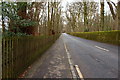
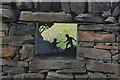
3
Monument Road
Leaving Alloway heading for Ayr.
Image: © Billy McCrorie
Taken: 24 Apr 2012
0.08 miles
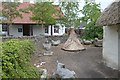
6
Pond at the Smallholding, Alloway
Situated at the rear of Burns Cottage.
Image: © Billy McCrorie
Taken: 13 May 2021
0.10 miles
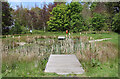
7
Pond at the Smallholding, Alloway
At the rear of Burns Cottage.
Image: © Billy McCrorie
Taken: 13 May 2021
0.10 miles
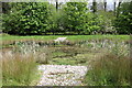
8
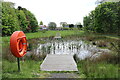
Pond at the Smallholding, Alloway
Looking up towards Burns Cottage.
Image: © Billy McCrorie
Taken: 13 May 2021
0.10 miles
9
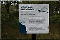
Pond and Woodland, Alloway
Sign in the Smallholding at the rear of Burns Cottage.
Image: © Billy McCrorie
Taken: 13 May 2021
0.10 miles