IMAGES TAKEN NEAR TO
Greentree Park, AYR, KA7 3SU
Introduction
This page details the photographs taken nearby to Greentree Park, KA7 3SU by members of the Geograph project.
The Geograph project started in 2005 with the aim of publishing, organising and preserving representative images for every square kilometre of Great Britain, Ireland and the Isle of Man.

There are currently over 7.5m images from over14,400 individuals and you can help contribute to the project by visiting https://www.geograph.org.uk
Image Map
Images are licensed for reuse under creativecommons.org/licenses/by-sa/2.0
Notes
- Clicking on the map will re-center to the selected point.
- The higher the marker number, the further away the image location is from the centre of the postcode.
Image Listing (15 Images Found)
Images are licensed for reuse under creativecommons.org/licenses/by-sa/2.0
Image
Details
Distance
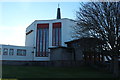
1

Junction, Burnbank Road and Dalmellington Road
Image: © Alan Reid
Taken: 26 Feb 2019
0.16 miles
2

Woodland Walk
A woodland walk in Castlehill Park, Ayr. This small woodland is surrounded by housing.
Image: © Mary and Angus Hogg
Taken: 24 Jan 2008
0.16 miles
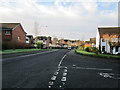
3

Castlehill Park
Children's play area in Castlehill Park, operated by South Ayrshire Council.
Image: © Mary and Angus Hogg
Taken: 24 Jan 2008
0.19 miles
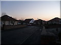
4

Briar Grove
Taken just before dusk on New Year's Day.
Image: © Norman Brown
Taken: 1 Jan 2009
0.21 miles
5
Briar Grove
Taken just before dusk on New Year's Day
Image: © Norman Brown
Taken: 1 Jan 2009
0.21 miles