IMAGES TAKEN NEAR TO
Cedar Road, AYR, KA7 3PE
Introduction
This page details the photographs taken nearby to Cedar Road, KA7 3PE by members of the Geograph project.
The Geograph project started in 2005 with the aim of publishing, organising and preserving representative images for every square kilometre of Great Britain, Ireland and the Isle of Man.

There are currently over 7.5m images from over14,400 individuals and you can help contribute to the project by visiting https://www.geograph.org.uk
Image Map
Images are licensed for reuse under creativecommons.org/licenses/by-sa/2.0
Notes
- Clicking on the map will re-center to the selected point.
- The higher the marker number, the further away the image location is from the centre of the postcode.
Image Listing (17 Images Found)
Images are licensed for reuse under creativecommons.org/licenses/by-sa/2.0
Image
Details
Distance
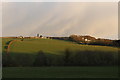
1

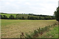
Briar Grove
Taken just before dusk on New Year's Day.
Image: © Norman Brown
Taken: 1 Jan 2009
0.08 miles
2
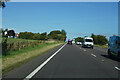
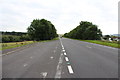
Traffic on the A77
On a bright and sunny day there was a lot of traffic on the A77.
Image: © Malcolm Neal
Taken: 20 Sep 2022
0.08 miles
3

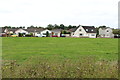
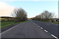
Housing Estate near Castlehill, Ayr
Busy road on the left is the A77.
Image: © Billy McCrorie
Taken: 2 Sep 2014
0.09 miles