IMAGES TAKEN NEAR TO
Holmston Drive, AYR, KA7 3JT
Introduction
This page details the photographs taken nearby to Holmston Drive, KA7 3JT by members of the Geograph project.
The Geograph project started in 2005 with the aim of publishing, organising and preserving representative images for every square kilometre of Great Britain, Ireland and the Isle of Man.

There are currently over 7.5m images from over14,400 individuals and you can help contribute to the project by visiting https://www.geograph.org.uk
Image Map
Images are licensed for reuse under creativecommons.org/licenses/by-sa/2.0
Notes
- Clicking on the map will re-center to the selected point.
- The higher the marker number, the further away the image location is from the centre of the postcode.
Image Listing (35 Images Found)
Images are licensed for reuse under creativecommons.org/licenses/by-sa/2.0
Image
Details
Distance
1
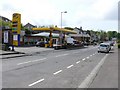
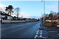
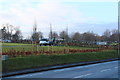
Hillfoot Road, Masonhill
Jet Service Station
Image: © Andy Farrington
Taken: 14 May 2010
0.10 miles
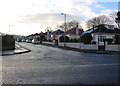
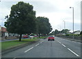
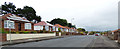
4
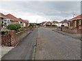
Allenfield Road
A vast area under bungalows on the east side of Ayr.
Image: © Richard Webb
Taken: 13 Aug 2014
0.18 miles
8
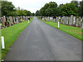
Ayr Cemetery
A formal, well maintained cemetery.
Image: © Thomas Nugent
Taken: 3 Aug 2018
0.19 miles
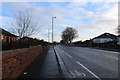
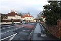
10
Forehill Road
Bungalows on the north side of the road, bordering Ayr Cemetery.
Image: © Thomas Nugent
Taken: 3 Aug 2018
0.20 miles