IMAGES TAKEN NEAR TO
Farrell Crescent, AYR, KA6 7EQ
Introduction
This page details the photographs taken nearby to Farrell Crescent, KA6 7EQ by members of the Geograph project.
The Geograph project started in 2005 with the aim of publishing, organising and preserving representative images for every square kilometre of Great Britain, Ireland and the Isle of Man.

There are currently over 7.5m images from over14,400 individuals and you can help contribute to the project by visiting https://www.geograph.org.uk
Image Map (Loading...)


Getting Data...Please wait
Leaflet Map data © OpenStreetMap
Images are licensed for reuse under creativecommons.org/licenses/by-sa/2.0
Notes
- Clicking on the map will re-center to the selected point.
- The higher the marker number, the further away the image location is from the centre of the postcode.
Image Listing (22 Images Found)
Images are licensed for reuse under creativecommons.org/licenses/by-sa/2.0
Image
Details
Distance
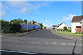
1

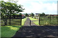
Drongan
As seen on approach to Prestwick Airport, with Drongan Hall farm in the right foreground.
Image: © M J Richardson
Taken: 18 Aug 2010
0.16 miles
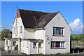
2
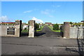
St Clare's, Watson Terrace, Drongan
Roman Catholic church opened in 1967
Image: © Leslie Barrie
Taken: 13 May 2014
0.17 miles
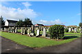
5
The Schaw Kirk, Drongan
Church of Scotland. Built 1955-56.
Image: © Leslie Barrie
Taken: 13 May 2014
0.19 miles
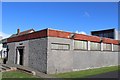
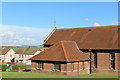
8
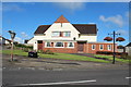
Public House, Drongan
On the corner of Watson Terrace and Littlemill Road.
Image: © Billy McCrorie
Taken: 7 Aug 2014
0.19 miles