IMAGES TAKEN NEAR TO
Old Toll, AYR, KA6 6LP
Introduction
This page details the photographs taken nearby to KA6 6LP by members of the Geograph project.
The Geograph project started in 2005 with the aim of publishing, organising and preserving representative images for every square kilometre of Great Britain, Ireland and the Isle of Man.

There are currently over 7.5m images from over14,400 individuals and you can help contribute to the project by visiting https://www.geograph.org.uk
Image Map
Images are licensed for reuse under creativecommons.org/licenses/by-sa/2.0
Notes
- Clicking on the map will re-center to the selected point.
- The higher the marker number, the further away the image location is from the centre of the postcode.
Image Listing (110 Images Found)
Images are licensed for reuse under creativecommons.org/licenses/by-sa/2.0
Image
Details
Distance
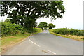
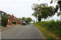
1
Sandyhill Terrace, near Ayr
A row of cottages to the east of Ayr, located near the Crematorium. Viewed on a bright December day.
Image: © Mary and Angus Hogg
Taken: 15 Dec 2009
0.02 miles
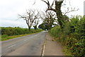
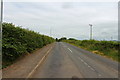
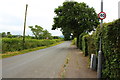
4
Road to the A70 at Sandyhill Terrace
Image: © Billy McCrorie
Taken: 15 Jul 2013
0.04 miles