IMAGES TAKEN NEAR TO
Catrine, MAUCHLINE, KA5 6HP
Introduction
This page details the photographs taken nearby to KA5 6HP by members of the Geograph project.
The Geograph project started in 2005 with the aim of publishing, organising and preserving representative images for every square kilometre of Great Britain, Ireland and the Isle of Man.

There are currently over 7.5m images from over14,400 individuals and you can help contribute to the project by visiting https://www.geograph.org.uk
Image Map
Images are licensed for reuse under creativecommons.org/licenses/by-sa/2.0
Notes
- Clicking on the map will re-center to the selected point.
- The higher the marker number, the further away the image location is from the centre of the postcode.
Image Listing (9 Images Found)
Images are licensed for reuse under creativecommons.org/licenses/by-sa/2.0
Image
Details
Distance
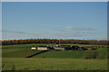
4
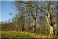
Woodland & drystane dyke north of Catrine Mains
Image: © Leslie Barrie
Taken: 5 Nov 2012
0.18 miles
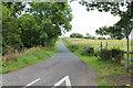
7
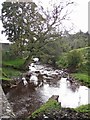
The Burn o' Need from Shellies Bridge
The bridge carries the Mauchline Road over the burn. The burn is a tributary of the River Ayr.
Image: © Richard Dorrell
Taken: 28 Sep 2012
0.21 miles
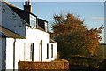
8
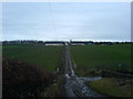
Croftfoot Farm
Croftfoot Farm from the old track to Catrine.
Image: © David Johnston
Taken: 1 Mar 2007
0.21 miles