IMAGES TAKEN NEAR TO
Mansfield Road, MAUCHLINE, KA5 6AH
Introduction
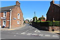
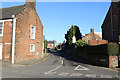
This page details the photographs taken nearby to Mansfield Road, KA5 6AH by members of the Geograph project.
The Geograph project started in 2005 with the aim of publishing, organising and preserving representative images for every square kilometre of Great Britain, Ireland and the Isle of Man.

There are currently over 7.5m images from over14,400 individuals and you can help contribute to the project by visiting https://www.geograph.org.uk
Image Map
Images are licensed for reuse under creativecommons.org/licenses/by-sa/2.0
Notes
- Clicking on the map will re-center to the selected point.
- The higher the marker number, the further away the image location is from the centre of the postcode.
Image Listing (178 Images Found)
Images are licensed for reuse under creativecommons.org/licenses/by-sa/2.0
Image
Details
Distance
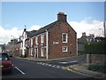
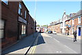
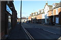
4
Corner of Earl Grey Street & Mansefield Road, Mauchline
Image: © Leslie Barrie
Taken: 26 Mar 2014
0.04 miles
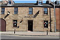
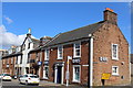
6
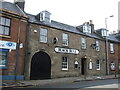
The Black Bull, Mauchline
On Earl Grey Street.
Image: © JThomas
Taken: 21 May 2021
0.05 miles