IMAGES TAKEN NEAR TO
Catrine Road, MAUCHLINE, KA5 6AD
Introduction
This page details the photographs taken nearby to Catrine Road, KA5 6AD by members of the Geograph project.
The Geograph project started in 2005 with the aim of publishing, organising and preserving representative images for every square kilometre of Great Britain, Ireland and the Isle of Man.

There are currently over 7.5m images from over14,400 individuals and you can help contribute to the project by visiting https://www.geograph.org.uk
Image Map
Images are licensed for reuse under creativecommons.org/licenses/by-sa/2.0
Notes
- Clicking on the map will re-center to the selected point.
- The higher the marker number, the further away the image location is from the centre of the postcode.
Image Listing (35 Images Found)
Images are licensed for reuse under creativecommons.org/licenses/by-sa/2.0
Image
Details
Distance
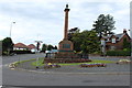
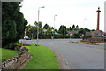
4
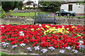
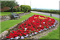
Flower Garden at Mauchline
With the seat commemorating World War 1.
Image: © Billy McCrorie
Taken: 21 Aug 2015
0.03 miles
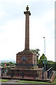
8
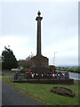
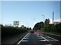
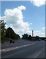
War Memorial, Mauchline
Beside the A76 at the junction with the B705.
Image: © JThomas
Taken: 21 May 2021
0.04 miles