IMAGES TAKEN NEAR TO
Tarbolton, MAUCHLINE, KA5 5NW
Introduction
This page details the photographs taken nearby to KA5 5NW by members of the Geograph project.
The Geograph project started in 2005 with the aim of publishing, organising and preserving representative images for every square kilometre of Great Britain, Ireland and the Isle of Man.

There are currently over 7.5m images from over14,400 individuals and you can help contribute to the project by visiting https://www.geograph.org.uk
Image Map
Images are licensed for reuse under creativecommons.org/licenses/by-sa/2.0
Notes
- Clicking on the map will re-center to the selected point.
- The higher the marker number, the further away the image location is from the centre of the postcode.
Image Listing (7 Images Found)
Images are licensed for reuse under creativecommons.org/licenses/by-sa/2.0
Image
Details
Distance
1
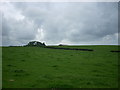
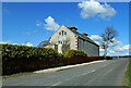
East Carngillan Farm
East Carngillan Farm shed from road to Tarbolton Station
Image: © robin mcgill
Taken: 20 Aug 2013
0.05 miles
4
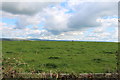
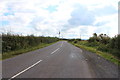
Carngillan, Ayrshire
Looking towards the junction of B743 (Mauchline to Ayr) from the B730 (Stair to Tarbolton). Plenty litter on these roads. Note the cottages have been renovated since the last visitor Image
Image: © wfmillar
Taken: 12 Mar 2012
0.22 miles
5
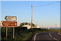
Stairgillan House
On the B730 to the south of Tarbolton.
Image: © Mary and Angus Hogg
Taken: 14 Apr 2021
0.22 miles
7

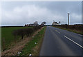
Old Milestone by the B743, Tarbolton parish
Ayr granite by the B743, in parish of Tarbolton (Carrick District), near minor crossroads, East of B730 crossroads, on verge, South side of road.
Inscription reads:-
: Ayr / 7 : : Mauchline / 4 / Muirkirk / 17¼ :
Surveyed
Milestone Society National ID: AYS_AYMK07
Image: © Milestone Society
Taken: Unknown
0.24 miles